
I met Kristina in Elterwater at 10am, and we started off by running through the two GPS systems, plus a pretty cool App that she had on her iphone. After covering the main uses of GPS we set a route in and got on our way. The sky was a bit murky, but the main thing was it wasnt raining, and there was not a breath of wind, it was quite nice! Our planned route took us up and over Lingmoor Fell. The views were spectacular, as the surrounding fells were all sugar coated with snow. On our way off the fell we went via Lingmoor Tarn which was frozen solid. We couldn't miss out on the opportunity (I say we, I mean me really!) to throw some rocks onto the ice to try and crack it. Most impressively was the stone I managed to skim across to the other side...honestly the ice didn't help too much! Whilst on the route we looked at how the GPS was following our route, as well as discussing the limitations of GPS. We descended back to Elterwater along the road via Blea Tarn.
Monthly Archives: January 2012
-
GPS Training
-
Great Cockup to Great Calva
A great day in the snow today on the Back O'Skiddaw Fells, following a route from Great Cockup to Great Calva.
We set off from Orthwaite at 10am and climbed the western shoulder of Great Cockup with little difficulties, by the time we reached the summit we were in plenty of snow, and sunshine!
We descended crossing Trusmadoor and climbing the steep western slopes to the summit of Meal Fell. The snow on Meal Fell was much deeper, and there was quite a strong wind now blowing the snow into quite deep drifts at times.
From Meal Fell we climbed west directly to the summit of Great Sca Fell and after a short time in the shelter on the climb we emerged at the summit cairn, back into the wind, but with some magnificent views all round.
From Great Sca Fell we followed the ridge south climbing to the broad summit of Knott. There was little point in stopping on the top for too long today so after a few pictures we continued south crossing the col to climb to the summit of Great Calva. On the way we stopped for a short lunch stop when we found a little shelter from the wind before continuing to the summit.
We descended west by White Hause before dropping below the snow line and picking the path up by Brockle Crag back to Orthwaite.
A great day in pretty hard conditions.
-
Silver How Navigation Course
Wow, what an amazing day to be out on the fells! Not a breath of wind, clear blue skies, nice temperature, and snow capped fells all around...Magic!
I met Mark, Carole and Jess (the Dog) in Elterwater and after covering Grid references, map symbols and orientation we got cracking towards Silver How. The ground was hard in most places, but now snow down to the roadside. We covered pacing, timing and following the map whilst slowly making our way towards the summit. We had a spot of lunch and enjoyed the amazing views before covering bearings in the afternoon.
-
Navigation Training Course (Day 2)
Today Clare returned for day two of her navigation, aiming to get her Silver NNAS. We were also joined by one of our new instructors Alex Wride today.
The morning started clear, and we made our way towards Lingmoor Fell. Through multiple nav legs we made our way up the tracks and onto the fellside. Not before long it started to rain/ hail/ snow, we really were getting a mixture of it all! Clare continued to navigate well despite these conditions, however our stomachs put a stop to the play as we stopped for some lunch in one of the many old miners shelters. The temperature felt like it had really dropped, so we pressed on with some navigation, now working on the 1:50k maps. After a few legs using this map, we reverted back to the 1:25k map for the last few legs.
-
Wansfell from Ambleside
Starting from our shop in Ambleside, we made our way towards Stock Ghyll Force. The waterfalls were spectacular and a great we to start the walk! We were now faced with a steep climb (the only one of the day) to the first summit of Wansfell.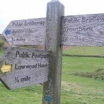
-
The Langdale Pikes
A windy day climbing The Langdale Pikes from the New Dungen Ghyll Hotel in the Langdale Valley, taking in four summits before descending by Dungeon Ghyll -
Threading the Needle, Sphinx Ridge and Pinnacle Ridge
With my friend up, a few days off and the nice break in the weather continuing, we thought today would be a great day for some scrambling! We set off from Seathwaite and made our way up to Styhead Pass. We took the start of the climbers path that traverses across the amazing Southern face of Great Gable. We made our way across the boulders following the track towards the Napes. Soon enough we were staring up at Napes Needle, but we stopped here for a spot of lunch and admired the clear views over Wastwater and over to the Scafells. 'Threading the Needle' is to scramble around the back of the Needle, which is easier said than done, but still great fun all the same! The right hand side is a steep chimney which tests your climbing ability, but with a bit of shimmying and twisting we were standing behind the Needle. To complete the thread we had to down climb the left hand side, which is a steep polished section, and after a few careful foot placements we had done it. This was a great start to the scrambling, and now we were to follow the Climbers Traverse to the start of Sphinx Ridge. The Sphinx Ridge has the aptly named Sphinx Rock at its base, so the start of the ridge is easy to find. The ridge starts up a gully but soon enough you emerge onto the crest of the ridge for some fantastic scrambling. At the top of the scramble all the Napes Ridges merge into one grassy bank, which gives it a great Alpine Feel (but no snow! :( ) In front of us we now have the Westmorland Crag, which holds Pinnacle Ridge. A very short descent down some scree leads to the base of this Ridge. The scramble starts with some steps and then goes past the pinnacles. It finishes with easy rocks which turn into a path that then leads to the summit. We enjoyed the view from the summit and then descended over Green Gable and round Base Brown back to Seathwaite.
This was a fantastic day of scrambling, and one of the many routes we will be offering in 2012 on our scrambling days.
-
Helvellyn from Wythburn
Another fantastic day forecast and blimey did it produce one! I met Claire and Gina at Wythburn and we got moving straiught away before our toes fully froze! The start of the climb was steep, but it warmed us up and gave us good height gain early on to gain some spectacular views, especially as much of the ground was white with frost. We climbed around Comb Crags and started to feel the wind, which started to cool us down a little. The views continued to get better and better as we made our way to Helvellyn. On our way to Helvellyn we got amazing views of Striding Edge, and before summiting we went to the exit ramp of the edge to have a look directly down onto it. We had a spot of lunch on the summit but didnt stop long as it was quite chilly. This was when the felltop conditions man appeared on the summit and Gina went to ask him what the temperature was. He told us it was -3.6 degrees C, but -12 with Windchill! and it did feel it!
We walked the short distance southwards to the summit of Nethermost Pike, and then round over High Crag to Dollywagon Pike, where we were rewarded with amazing views down the Grisedale Valley. It was here we saw the interesting flying saucer like clouds (see picture). We descended down to Reggle Knott over the frozen boggy ground, where again we had great views, this time of the full length of Thirlmere. We walked back to Wythburn along the flat track in the forest. A fantastic day to be in the fells!
-
Silver How Navigation Training
A great day above Elterwater today with a Navigation Training Course.
We set off from Elterwater at 10am and climbed above High Close, following the ridge west climbing eventually by Meg's Gill to the summit of Silver How. After a short lunch stop on the summit of Silver How we continued west running several navigation exercises as far as Swinescar Pike before descending by Thrang Crag to Chapel Stile and following the river back to Elterwater.
-
Scafell Pike
Another clear crisp winter day on the cards, and what a great place to be going, the summit of Scafell Pike!
We set off from Seathwaite towards Stockley Bridge and we were all very excited about what the day was going to hold, the weather was just fantastic! We reached Stockley Bridge and climbed up past Taylor Force Gill. We were encountering large bits of ice on the path, so we were wondering what we would encounter higher up. We got to Styhead Pass and admired the surrounding mountains before making our way onto the Corridor Route. We made great progress up the path, stopping to admire the view doen the Wasdale Valley, as well as the stunning face of Great Gable. Soon enough we were at Lingmell Col and on the final ascent. On the way up we went to the impressive viewpoint that looks down to Wastwater below. We reached the summit, which was actually quite busy. There was a bit of a wind so we gained some shelter beside the large summit cairn and quickly gobbled down some sarnies. We didn't stop long as it was so cold so we made our way off the summit towards Broad Crag Col. We continued to enjoy the amazing views along the tops of Broad Crag and Ill Crag before dropping down via Calf Cove to the top of Grains Gill. The path down Grains Gill had a lot of ice on it so we took our time, but we made it back to Seathwaite with big smiles on our faces from such a great day out!
-
Steel Fell to Helm Crag
A wonderful day above Grasmere today from Steel Fell to Helm Crag.
We set of from Grasmere at 10am and followed the lane to Helmside from where we climbed the southern shoulder of Steel Fell.
The views from Steel Fell were amazing today, a perfect view north over Thirlmere to Skiddaw matched the magnificent views south over Grasmere to Morecambe Bay and Yorkshire.
From Steel Fell we followed the ridge west crossing the boggy ground near Griffin Tarn before climbing to the summit of Calf Crag, stopping for lunch by the summit cairn to admire the view over Far Easdale.
After lunch we followed the ridge, descending to Gibson Knott and Helm Crag and after a short scramble on the Howitzer we descended the steep path into Easdale and followed the lane back to Grasmere.
-
Silver How Navigation Training.
I met Claire in Elterwater and we started off by discussing her previous experience with a map and compass. Claire told me that in the future she hopes to lead walking groups, so coming and working towards her Silver NNAS Award is a great way to start!
We discussed Grid References, map symbols contours and orientation before setting off towards the fells. We completed multimple Nav legs as we made our way towards Silver How, each time covering something new such as Pacing or timing. After finding our usual hidden sheepfold we sat and enjoyed some lunch, along with the views as it was a glorious day! After refuelling we ran through bearings and spent the afternoon putting everything taught throughout the day into practice. We finished the day with a nice gentle stroll off the fells enjoying the weather.
-
Scafell Pike from Seathwaite
I met the group at Seathwaite Farm, and just as we set off we were caught in a rain storm. Fortunately for us it didn't last long at all! We made our way to the Stockley Bridge and then climbed above Taylorgill Force to Styhead Tarn. From Styhead pass we joined thr Corridor Route and started to make our way upo the hillside. The cloud was blowing across the tops and occasionally allowing us a few minutes to look up at the summit of Scafell Pike. As we got to Lingmell Col we were in the mist, and had moved into a strong South Westerly wind. We trudged up the steep ascent and summited Scafell Pike, before making quick progress into shelter and out of the strong wind.
With the temperature easily down to about -5 in the wind we didnt stop for long. Our usual route over towards Great End still had large amounts of snow on the northern slopes, and this coupled with the strong winds that we would be exposed to over the tops, we decided to descend via the Corridor Route.
We made good progress off the hill and made our way back to Seathwaite Farm.
-
Scafell Pike from Seathwaite
January 2nd and we have our first ascent of over a hundred for the year up Scafell Pike. The forecast was again showing some grim weather which included snow showers, and with the sleet smashing off my windscreen on the way to Seathwaite, I thought it was going to be a bit of a wild one!
I met the group at Seathwaite Farm and there was a nice break in the weather, and the cloud base was suprisngly high, maybe it was going to be ok, but having been caught out just minutes from the car before, I donned my waterproofs straight away. We made our way to Stockley Briudge and climbed past Taylorgill Force. With no sign of rain we all started to overheat a little, as we even started calling it 'quite mild!' After a quick layer adjustment we made our way to Styhead Pass and admired the surrounding fells. There was not much evidence of snow on the ground apart from the odd patch up high. We joined the Corridor Route and made great time as we ascended to Lingmell Col. As we joined the track to ascend Scafell Pike we emerged into a strong wind. We got to the Zig Zags and as we got to the western face of the ascent it turned into a winter wonderland. All the rocks had been blasted with Ice, and although pretty it meant we had to walk with extra caution. As we got higher and higher the ice got more and more impressive. We reached the summit plateau in the mist and the summit emerged out of the cloud. We bagged the trig point and quickly saught shelter in our usual spot (Although there was a massive pile of snow taking up half the shelter!) After a great lunch to refuel we went to head off the summit to the north to follow our usual route towards Great End. A big patch of consolidated snow was covering most of this northern aspect, and with a couple more northern slopes to descend later in the route we opted to return via the Corridor route.
We made quick progress back down to the Corridor route in order to get out of the wind. We had great views back down Borrowdale and into Wasdale all the way. We returned via Styhead Tarn and back down past the Stockley Bridge. Just as we got back to the cars a hail storm started, now thats what you call timing! A fab day out!
-
Helvellyn from Wythburn
2012 is here, and what a great way to spend new years day!
Starting at Wythburn Church we pretty much started our ascent from the first step as we made our way through the forest. As we emerged from the forest we came into an amphitheatre like comb which was absolutely stunning, especially as the recent rain was making all the streams very clear. We continued to ascend on the good path to the very aptly named Comb Crags. The path made its way through the crags before turning to the North making its way over Birk Side. Soon after we were on the main plateau by Nethermost Pike, but our first objective of the day was Helvellyn. Up until this point we had been rained on a bit but the loud was still above the summits. As we made our way towards the summit the cloud dropped and with it our view disappeared. There were still quite a few Cornices hanging around which was good to see. We made it to the Summit of Helvellyn where we could see even bigger cornices forming over the steep back wall. To have a break and shelter from the weather we sat in the shelter and enjoyed our lunch.
We continued the walk by turning south and summiting the flat top of Nethermost Pike . We rejoined the main path which led us towards High Crag and then Dollywagon Pike, where we got spectacular views straight down the Grisedale Valley, and out to Ullswater in the distance. With all our summits bagged we started to descend down towards Willie Wife Moor. Just a few metres into the descent a hail storm set in, which really hurt! Like real mountaineers we pressed on.... however this was short lived (literally 30 seconds!) and I quickly grabbed the group shelter out of my bag and we sought some shelter while the storm went over (this turned out to be one of the favorite bits of everyone's day!). The storm did soon pass and with our stinging faces we continued our descent, and that was actually the last of the bad weather. We got to Reggle Knott, a large rocky outcrop and were rewarded with fine views down pretty much the full length of Thirlmere.
Just a short descent from here brought us to the track that led us back to our start point at Wythburn Church. A thoroughly enjoyable day out on a fantastic route!
15 Item(s)
