Welcome to The Lake District Walker
Shopping Cart - £0.00

You have no items in your shopping cart.

Return to Previous Page
Daily Navigation Courses: Beginners Day

Beginners Navigation Course: Saturday 31st August 2013

Be the first to review this product

£100.00
Product code: 1577

Availability: In stock

Only 4 places remaining

  • Book a group of 2 for £60.00 per person
  • Book a group of 3 for £50.00 per person

Quick Overview:

We run navigation Training courses 365 days a year, just pick your date from the diary below.

This mountain navigation course is ideal for anyone who wants to be self sufficient in the mountains of the UK.

This course is perfect for anyone with little or no prior navigation experience. Whether you are a hill walker who wants to be able to head out in all weathers, considering enrolling on the Mountain Leader scheme, or a climber who wants to be able to navigate from the top of the route back down to the pub in the dark, the skills are the same.
More information...

* Required Fields

£100.00
Add to Cart
Add to Compare
Add to Wish List
Alternatively...
Wansfell from Ambleside: Wednesday 28th August 2013
£20.00
Low Fell & Fellbarrow: Friday 2nd August 2013
£20.00
Lake District Photography Course: Thursday 22nd August 2013
Lake District Photography Course: Thursday 22nd August...
£125.00
Advanced Navigation Course: Sunday 25th August 2013
£100.00

Details

Difficulty: Moderate
  Walking over rough ground at times
Distance: 10km / 6 miles approx.
Ascent: 500m+ / 1500ft+ approx.
Time: 6/7 hours
Start Time: 10am
Maximum Group Size: 4
Minimum Group Size: 1


"The mountains will always be there, the trick is to make sure you are too."
Hervey Voge

This mountain navigation course is ideal for anyone who wants to be self sufficient in the mountains of the UK.

This course is perfect for anyone with little or no prior navigation experience. Whether you are a hill walker who wants to be able to head out in all weathers, considering enrolling on the Mountain Leader scheme, or a climber who wants to be able to navigate from the top of the route back down to the pub in the dark, the skills are the same.

If you have existing navigation skills we will be able to build on these over the course.

The course is suitable for anyone over the age of 18. There is no maximum age and we regularly get a mixture of ages and experience and are used to tailoring the course to meet the needs of a varied group of people.


"Whoever Mr. Watson may have been, it is a very odd Dodd that has been selected to perpetuate his name."
A Wainwright

What does the course cover?

  • One day of practical navigation in the mountains of Cumbria
  • Introduction to different map scales
  • Setting the map
  • Interpreting contours
  • Key symbols, i.e. how to find a footpath, fence, stream, etc., and how to interpret them
  • Planning and following a route using paths and other key features
  • How to plan and follow a route across featureless terrain
  • Estimating distances using pacing and timing
  • Navigating in poor or limited visibility
  • How to use the compass

Each participant will be required to bring suitable equipment for their chosen event, please see Equipment Required.


Where to meet: Outside the Britannia Inn, Elterwater
View Larger Map
Postcode: LA22 9HP
Grid Reference: NY 327 048

Directions

From Ambleside take the A593 (Coniston) for 3 miles, turning right at Skelwith Bridge onto the B5343. After 2 miles turn left into Elterwater Village and The Britannia Inn is on the village green.

Write Your Own Review

Only registered users can write reviews. Please, log in or register

Product Tags

Use spaces to separate tags. Use single quotes (') for phrases.

  • Navigation Training on Loughrigg

    A good day today despite heavy showers, we spent the day on the ridge between Loughrigg and Silver How practising navigation, climbing from Ambleside to Loughrigg via Lilly Tarn.

    We stopped for lunch on the summit of Loughrigg between showers before continuing along the ridge to Silver How and descending to Grasmere.

  • Navigation Training on Silver How

    Another days navigation training today, climbing from Chapel Stile we made our way along the Silver How ridge with several excersises on route before descending back to Chapel Stile by Meg's Gill.

  • Navigation Training on Silver How

    A good day despite heavy showers today on Silver How, we climbed from Elterwater onto the ridge above High Close Youth Hostel and undertook several navigation excercises along the ridge and over Silver How and above Blindtarn Moss before descending down to Chapel Stile and Elterwater.

    Strong wind and a few heavy showers in the early afternoon made the conditions interesting for a little while.

  • Silver How Navigation Training

    A good day above Elterwater today practising navigation skills.

    We climbed from the village onto the ridge above High Close before following the ridge to eventually have lunch on the summit of Silver How with a magnificent view over Grasmere and Rydal Water.

    After lunch we continued along the ridge towards Blea Rigg before doubling back on ourselves and descending by Megs Gill back down to the Valley at Chapel Stile and walking back alongside the river to Elterwater.

  • Flooded Borrowdale Navigation Training

    A very wet day on a Navigation Training course in Borrowdale today.

    It was decided early on not to go too high as the weather was very wet and windy so we ran several exercises on the lower slopes of Grange Fell, and above Grange Crags before crossing the lower slopes of Kings How via a few caves to the Bowder Stone.

    The heavy rain all day by now had caused some flooding in the Borrowdale Valley meaning that we couldn't cross the river at Rosthwaite as planned, instead we climbed the northern slopes of Kings How and descended to Troutdale to return to Grange.

  • Silver How Navigation Training

    A cold day on Silver How with a Navigation Training Course today.

    From Elterwater we climbed onto the ridge above High Close and ran several navigation exercises along the ridge over Silver How and as far as Blea Rigg.

    There was a strong northerly wind all day and it was very cold in the wind, there were occasional snow showers during the day, but there were some great views of the higher fells surrounding us.

    We descended by Meg's Gill to Chapel Stile and followed the river path back to Elterwater.

  • Grange Fell Navigation Training

    A good day on Grange Fell today with a Navigation Course, running several exercises as we cimbed to the summit of Kings How and onwards to Brund Fell, the summit of Grange Fell before continuing over much of the rough ground to the north of Brund Fell.

    A great day with a covering of snow on Grange Fell and some amazing views over Borrowdale, and a nice surprise as we came across a herd of deer as we descended back towards the trees.

  • Navigation Training – Grange Fell

    Good day spent navigating around Grange Fell.
    After climbing to King's How, we stopped for lunch then continued to Brund Fell. We then negotiated lumps, bumps and a few walls for the rest of the afternoon before returning to Grange.

  • Silver How – Navigation Trining

    A good days Navigation Training on Silver How today.

    We set off from Elterwater and climbed above the High Close Youth Hostel and ran several exercises between her and the summit of Silver How, stopping for lunch just below the summit of Swinescar Pike.

    We continued a little further along the ridge towards Blea Rigg before doubling back and descending by Megs Gill down to Chapel Stile and following the river back to Elterwater.

  • Silver How - Navigation Training

    A great day on Silver How today with a Navigation Training Course.

    We set off from Elterwater at 10am and climbed onto the Silver How Ridge above High Close and followed the ridge over Silver How and along to Swinescar Pike running several navigation exercises along the way, descending to Chapel Stile by Megs Gill and following the river back to Elterwater.

    A fantastic day with some great views throughout.

  • Silver How Navigation Training

    Navigation Training today on Silver How, the weather wasn't great with low cloud and drizzle pretty much all day but we had  good day following the ridge from above Red Bank along over Silver How to Swinescar Pike, with several navigational exercises along the way.

    We descended by Megs Gill and Thrang Crag to Chapel Stile and followed the riverside path back to Elterwater.

  • Silver How - Navigation Training

    Wonderful weather today on Silver How for a Navigation Training day. We sett off from Elterwater in bright sunshine and climbed onto the ridge above High Close and ran several navigation exercises along the ridge to Megs Gill before climbing to the summit of Silver How.

    We stopped for lunch on Silver How to admire the view over Grasmere and Rydal Water, without a breath of wind, before continuing along the ridge by Lang How and Swinscar Pike, descending by Megs Gill to Chapel Stile and back along the river to Elterwater.

  • Lingmoor Fell Navigation Training

    A good days Navigation Training on Lingmoor Fell today. We climbed from Elterwater by Banks Quarry and up onto Lingmoor Fell running several navigation exercises on the southern slopes of the fell.

    We climbed to the summit, Brown How, stopping for lunch on the top before descending towards Lingmoor Tarn with several more exercises en route back towards Lingmoor Quarry and down by Bield Crag to Dale End and the track back to Elterwater.

  • Silver How Navigation Training

    A near perfect day again today on Silver How for a Navigation Training Course, we set off from Elterwater at 10am and climbed above Red Bank onto the Silver How Ridge near Dow Bank, running several navigation exercises along the ridge to reach the summit of Silver How for lunch.

    After lunch we continued west along the ridge as far as Swinescar Pike before returning to descend to Chapel Stile by Megs Gill and following the river back to Elterwater.

  • NNAS Silver Course

    Two great days running a navigation course. Day one was spent on Silver How and on day two we negotiated lumps, bumps and tarns on Loughrigg Fell.
    The weather was fantastic throughout.

  • Grange Fell Navigation Training

    A good day on Grange Fell today with a Navigation Training Day.
    We set off from Grange just before 10am and climbed through the woods above Troutdale to the summit of Kings How with several navigational exercises en route, continuing to the summit of Brund Fell, the highest point on Grange Fell, where we stopped for lunch.
    After lunch we continued along the northern ridge with several more exercises before descending back to Grange by a cave.

  • NNAS Silver Navigation Course

    Great weekend running a Silver NNAS course. Based at Elterwater, day one was spent on Silver How running various navigation exercises. Day two was spent on Loughrigg Fell, navigating our way around lumps, bumps, tarns and ponds.

  • Navigation Training Silver How

    A good days Navigation Training on Silver How today, once again with some wonderful weather.

    We set off from Elterwater at 10am and ran several navigation exercises above High Close and along the ridge to the summit of Silver How where we stopped for lunch.

    After lunch we continued west along the ridge with several more practical exercises before descending by Meg's Gill to Chapel Stile and following the river back to Elterwater.

  • Lingmoor Fell Navigation Training

    Another good day on Lingmoor Fell today, this time on a Navigation Training day.

    We climbed from Elterwater and ran several navigation exercises on the way to the summit of Lingmoor Fell where we stopped for lunch before descending to Lingmoor Tarn and then making our way down to Little Langdale and back to Elterwater.

  • Silver How Navigation Training

    A great day on the Silver How ridge today with a Navigation Training course.

    Setting of from Elterwater at 10am we climbed onto theridge above High Close and followed the ridge over Dow Bank to Silver How, running several navigation excercises on the way to the summit.

    After lunch we continued along the ridge past Swineside Pike before descending to Chapel Stile and following the river back to Elterwater.

  • Lingmoor Fell Navigation Training

    Another good day today with a Navigation Training course, this time on Lingmoor Fell.

    We ran several navigation exercises across the southern slopes of Lingmoor Fell to Busk Pike before climbing to the summit here we stopped for lunch before a long loop around Lingmoor Tarn and back over the main ridge brought us down to the Little Langdale Valley and the path back to Elterwater.

  • Silver How Navigation Training

    A great day on the Silver How ridge today on a Navigation Training Course. The near perfect weather made it an enjoyable day as we climbed from Elterwater above High Close and followed the ridge west running several navigational exercises as we crossed Silver How to Swinescar Pike.

    We returned from Swinescar pike to descend to Chapel Stile by Megs Gill before following the river back to Elterwater.

  • Silver How Navigation Training

    A good day on Silver How today with an Navigation Training Course.

    From Elterwater we climbed above High Close and followed the ridge over Dow Bank to the summit of Silver How running several navigation exercise on the way to Silver How.

    On and off drizzle persisted for much of the morning, although after lunch this got a little heavier for a while it was much better than expected! After a short lunch stop on the summit of Silver How we continued west along the ridge exploring the area around Swinscar Pike.

    We descended to Chapel Stile by Thrang Quarry and followed the river back to Elterwater.

  • Lingmoor Fell Navigation Training

    Perfect weather on Lingmoor Fell today for day two of a Navigation Training Course.

    We set off from Elterwater and climbed by Banks Quarry and up onto the main ridge, the views  over Little Langdale were magnificent.

    We followed the southern slopes running several navigational exercises on the way to Busk Pike and up towards the summit of Lingmoor Fell.

    We stopped at the summit for our lunch and to admire the great views across Langdale to the Langdale Pikes.

    From the summit we returned along the ridge before descending by Bield Crag and down to the track back to Elterwater.

  • Silver How Navigation Training

    A damp day on Silver How with a Navigation Training Day.

    We set off from Elterwater at 10am and climbed above High Close making our way to the summit of Silver How running several navigation exercises on the way.

    After a short lunch stop on the summit of Silver How we continued to follow the ridge west crossing to Swinescar Pike and continuing as far as Raw Pike before returning by Sheep Crag and descending by Megs Gill to Chapel Stile and following the river back to Elterwater.

    A good day, although a little damp and windy at times!

  • Navigation Training

    The weather we had today was a lovely treat compared to the last few days, but typically it was a day where seeing nothing is preferred! Strange? Not for a Navigation Course.

    Jack and Lizzy met me in Grange and to start with me sat down and had a chat about what we were going to do for the day. We covered Map Types, scales, grid references and handrail features. Jack and Lizzy grasped this extremely quickly so we started to make our way onto the fells. Throughout the course of the day we covered all the basics needed to be able to navigate competently alone, such as map orientation, understanding of map symbols, bearings, timing, pacing, contour interpretation and even relocation. Jack and Lizzy continued to grasp all these elements well, and navigated exceptionally well over varying distances. I even incorporated some harder legs and points to aim for but they still managed to get it bang on. They left the course today having covered everything necessary, having learnt it all through a series of tasks and activities. Awesome!

  • Silver How Navigation Training

    A good days Navigation Training on Silver How today.

    We climbed from Elterwater and climbed above High Close onto the ridge and ran several navigation exercises along the ridge by Dow Bank and up to the summit of Silver How, stopping on the summit of Silver How for lunch and continuing after lunch along the ridge by Swinescar Pike before returning along the ridge to descend to the west of Megs Gill and down to Thrang Crag Quarries and Chapel Stile following the river back to Elterwater.

  • Navigation Training Course

    A wonderful day teaching Navigation in Elterwater today. I met Lyn outside the Britannia Inn and we started off the day by sitting on the benches in the sunshine running through Scales, Grid References, Map symbols and map orientation. We put these skills into practice and made our way onto the fells. I introduced Lyn to various techniques such as pacing anf timings as we made our way towards Silver How, and just before lunch we covered Bearings. After a nice spot of lunch Lyn spent the afternoon practising all of the skills she had been learning and improving each and every time. A great day navving around the fells in the sunshine! Written by Matt Burt

  • Silver How Navigation Training

    Perfect weather today as we headed up onto Silver How for a Navigation Training Day, Peter and I headed out from Elterwater just before 10am and climbed above High Close onto the Dow Bank ridge running several navigation exercises along the ridge before climbing to the summit of Silver How and then along the ridge to Swinescar Pike.

    After lunch we descended by Megs Gill and down to Thrang Quarries walking back by the river from Chapel Stile back to Elterwater.

    A wonderful day with some amazing views.

  • Silver How Navigation Training

    Day 1:

    The weather has produced yet another fantastic day on the fells!

    Myself, Clive, Claire and Bob met outside the Britannia Inn in Elterwater ready for 2 days of navigation training. We sat outside the Inn for a while running through some theory such as grid references, handrails and common map symbols. Soon enough we started some navigation and got on the move, climbing towards Silver How. We ran multiple navigation legs, each time learning more and more techniques such as pacing, distance and orientation. After a spot of lunch we continued up Megs Gill and at the top we ran through Bearings. Everyone was navigating well and all had more success when we made our way to the summit of Silver How. From the summit we conducted a final bearing for the day before having a nice leisurely stroll back down to Elterwater.

    Day 2:

    Another successful day navigating on the fells today! Again we met at the Brittania Inn but today we headed over towards Lingmoor Fell. We got straight into what we had learnt on day 1 and started making our way up the fellside. It was clear all members of the group were improving after each leg and developing a much better understanding of mountain navigation. After a spot of lunch we moved onto 1:50,000 maps, relocation and more contour interpretation. The day had flown by so after another individual leg each we made our way back off the fell and down to the Inn for a debrief (and a drink!). I am very happy to also say that over these 2 days, these 3 virtually novice navigators have all passed our NNAS (National Navigation Award Scheme) Silver Award.

    Written By Matt Burt

  • Silver How Navigation Training

    Day 1:

    I met Robin outside the Brit Inn in Elterwater this morning, and before we made our way towards the fells we sat on the benches and ran through some basics. After covering Grid References, scales, contours and map symbols we got on our way. We slowly worked our way up past Dub How and towards Silver How via multiple navigational legs, each time adding new techniques such as pacing and timings. At the bottom of Megs Gill me had a spot of lunch and enjoyed the stunning views (another great November day!). After lunch we moved onto bearings, stressing their effectiveness when done correctly. Robin picked up bearings extremely quickly, and with great accuracy so we continued to build on overall navigational tactics, combining everything we had learnt previously. After a few more legs we decided to turn back towards Elterwater and enjoy a leisurely walk back to the cars.

  • Navigation training

    Day 1:

    I met Catherine in Elterwater, and before we got going we discussed Catherine's current standard of navigation. After just a short chat with Caroline she clearly had enough knowledge to cover the basics such as grid references, map symbols etc so she wanted to focus on techniques such as bearings, and what to do when in thick mist. Taking all this into mind we headed straight for the fells. Along the way we covered pacing and navigational technique and before long we were up by Dub How. From here we could see Helvellyn with a blanket of snow on it, Winter is here!

    We spent most of the morning covering short navigational legs and focusing on distance, timing and pacing. Shortly after midday we had a spot of lunch and then focused on bearings. We got cauight in a hail storm and we both frantically threw on more layers. After the hail storm had passed we noticed Fairfield and its surrounding peaks were now covered snow too! We spent the next couple of hours using bearins and utilising all the techniques we had covered over the course of the morning.

    Day 2: Another clear morning in Elterwater today, with the higher fells in view holding more snow than yesterday!

    We focussed our navigation over towards Lingmoor Fell and after a couple of 'warm up' legs to refresh what was learnt yesterday, we continued some more complex legs, taking in all the techniques learnt. Catherine was navigating extremely well, so I progressively made each leg harder. We spent a lot of time on contour interpretation of which Catherine also grasped extrmely well. We also spent some time working on the 1:50,000 maps to test the same skills on a different scaled map. We finished the day just as a long shower was setting in and got back to Elterwater after another great day out! Congratulations to Catherine who also passed her NNAS silver award over the course of the two days!

  • Navigation Training Course

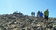
    Another great navigation course today, held on the low level fell of High Rigg in St John's in the Vale. I met Graham and we started the course by sheltering from the snow and hail storms by discussing grid references, map symbols and contours in the car. There is only so much navigation that can be done from the car, so we exited, got our kit on and headed out onto the fell. High Rigg is a fantastic venue as it offers the diverse lumpy landscape, scattered with walls tarns and streams, much like our main venue Silver How.

    The fell was covered in about 5cm of snow which was great fun to be walking on, and also provides different challenges when navigating. We covered handrails, distances, pacing and timings and finally bearings as we made our way up to the 343m cairn. The weather was coming across in quick fronts which was producing snow storms interspersed with clear weather and blue skies. We spent the remainder of the afternoon focusing on bearings, and refining the complete navigational process. We finished the day in the warmth of the Lodge with a nice bit of warm food and drink for a debrief. A fab day out!

  • Silver How Navigation Training

    A fantastic day on a navigation course, on a very wintry Silver How!

    I met ray, an aspirant ML in Elterwater, and after having a quick chat we were soon on our way up onto the fells. Ray was joining us on a navigation course to refresh his skills, as well as to learn some of the more technical elements such as contour interpretation. We climbed onto the undulating ground below Silver How and worked our way up onto the snow via Megs Gill. In places we were really exposed to the wind, which mixed with the falling snow made for some interesting conditions to navigate in!  Above about 350m we were walking on snow but these very wintry conditions did not phase Ray as he continued to navigate extremely well. We focused much of the day on contour interpretation, comparing the map to the ground and focusing on the intricate features. We got off the hill just before nightfall, slightly damp, but both having had a great day out on the fells.

  • Silver How Navigation Training

    A truley beatiful day out on the fells today!

    I met the Brendan, Ian and 12 year old Will at the Britania Inn, and all being self-procalaimed novice navigators we started from scratch. To start we covered Grid references, Map features, symbols and finally map orientation. The fells were beckoning so we got on our way. On our way up towards Dub How we covered pacing, handrails and a small amount of contour interpretation. Feeling a bit hungry we found a great lunch spot in the sun and enjoyed our sarnies with fabulous views of the Coniston Fells standing proud under a white blanket.

    We spent most of the afternoon working our way towards the summit of Silver How consolidating all the skills we had already covered, and then bearings. The summit plateau was very snowy and great fun to be walking on! We took a nice gentle stroll off the hill and enjoyed the views. A great day out, and Ian and Will will be out navigating with us again tomorrow!

  • Navigation Training Course

    Another great day on a navigation training course today! I met Chris in Elterwater and as usual started off by discussing his current navigational abilities. Chris had done map work previously and is a very keen walker, so wanted to be taught some of the grittier techniques such as pacings and bearings. We got on our way up towards Dub How, doing navigational legs on the way covering some of the basics such as handrails and catchment features. We spent the morning making our way up to the higher ground where it is better for bearing practice, and after walking up by Megs Gill we had a quick spot of lunch. Now up over the snow line, in the mist, plus the rain (which hadn't stopped all day!)  we had some perfect conditions for some tough nav practice. We spent the next couple of hours running nav legs which got progressively harder, starting with tarns then moving onto smaller contour features. Chris navigated exceptionally well and had obviously grasped the techniques. We took a nice stroll off the hill, just as some of the mist cleared to give some nice views down to Elterwater.

  • Silver How Navigation Training.

    I met Claire in Elterwater and we started off by discussing her previous experience with a map and compass. Claire told me that in the future she hopes to lead walking groups, so coming and working towards her Silver NNAS Award is a great way to start!

    We discussed Grid References, map symbols contours and orientation before setting off towards the fells. We completed multimple Nav legs as we made our way towards Silver How, each time covering something new such as Pacing or timing. After finding our usual hidden sheepfold we sat and enjoyed some lunch, along with the views as it was a glorious day! After refuelling we ran through bearings and spent the afternoon putting everything taught throughout the day into practice. We finished the day with a nice gentle stroll off the fells enjoying the weather.

  • Silver How Navigation Training

    A great day above Elterwater today with a Navigation Training Course.

    We set off from Elterwater at 10am and climbed above High Close, following the ridge west climbing eventually by Meg's Gill to the summit of Silver How. After a short lunch stop on the summit of Silver How we continued west running several navigation exercises as far as Swinescar Pike before descending by Thrang Crag to Chapel Stile and following the river back to Elterwater.

  • Navigation Training Course (Day 2)

    Today Clare returned for day two of her navigation, aiming to get her Silver NNAS. We were also joined by one of our new instructors Alex Wride today.

    The morning started clear, and we made our way towards Lingmoor Fell. Through multiple nav legs we made our way up the tracks and onto the fellside. Not before long it started to rain/ hail/ snow, we really were getting a mixture of it all! Clare continued to navigate well despite these conditions, however our stomachs put a stop to the play as we stopped for some lunch in one of the many old miners shelters. The temperature felt like it had really dropped, so we pressed on with some navigation, now working on the 1:50k maps. After a few legs using this map, we reverted back to the 1:25k map for the last few legs.

  • Silver How Navigation Course

    Wow, what an amazing day to be out on the fells! Not a breath of wind, clear blue skies, nice temperature, and snow capped fells all around...Magic!

    I met Mark, Carole and Jess (the Dog) in Elterwater and after covering Grid references, map symbols and orientation we got cracking towards Silver How. The ground was hard in most places, but now snow down to the roadside. We covered pacing, timing and following the map whilst slowly making our way towards the summit. We had a spot of lunch and enjoyed the amazing views before covering bearings in the afternoon.

  • Silver How Navigation Training

    A grey day today as we headed up onto Silver How for a Navigation Training day.

    A little rain had fallen this morning onto frozen ground making it a little slippery underfoot and once we were up onto the ridge we spent most of the day wearing crampons!

    We climbed above High Close before running several exercises over the summits of Silver How and Swinescar Pike before heading back along the ridge to Down Bank and descending back down to Elterwater.

    Mark did really well in some tough conditions today, at times it was near white out!

  • Silver How Navigation Training

    Day one of a two day navigation course today and Silver How was our destination. Meeting outside the Brit Inn in Elterwater we ran through some map based information such as Grid References, symbols and orientation. Not before too long we started to make our way up onto the fellside. The weather was glorious, with blue skies, crisp views and even a bit of heat from the sun! (Such a contrast from yesterday its mad!) As we worked our way up towards Silver How we covered Handrails, Catchment features, timings and pacings.

    Our lunch break was great. We sat and admired the views and even had a few fly pasts from RAF helicopters and Jets. We sent the afternoon focusing on bearings, as well as taking in the summit of Silver How. Martin and Anne navigated well today and took on everything very quickly. Up onto Lingmoor Fell tomorrow for some more practice and an NNAS Assessment.

  • Navigation Training Day 2

    Day 2 of the Navigation Training course today, and a good chance to learn a few new skills, but more importantly consolidate what was taught on day 1. From the Brit Inn in Langdale we started to make our way onto the fellside, and today it was to be Lingmoor Fell. Anne and Martin were given a couple of easier legs to start with to refresh their memories of some of the stuff we had previously covered, such as pacing, timing and orientation. As we climbed higher and made our way onto the high ridge on Lingmoor Fell we re-introduced bearings. After a few short legs focusing on bearings and pacings we found a nice little shelter to have some lunch in. Straight after lunch we moved onto working with the 1:50k maps, and with these Nav legs we made our way up to the summit. On the summit we grabbed a few pictures, and then I gave Anne and martin the task of Navigating back down to Elterwater using the skills they had learnt over the 2 days, with no input from me. They both navigated very well all day and this continued as they guided me back down to Elterwater. Over the course of the 2 days Anne and Martin met the criteria to pass the Silver NNAS Award, Well Done guys!

  • Silver How Navigation Training

    A great day running a Navigation Training Course on Silver How.

    After discussing Christine's current navigational abilities outside the Britannia Inn in Elterwater we made our way up onto the fellside. Along the way we ran through multiple techniques such as handrails, catchment features, countour interpretation, pacing and timings. Christine navigated very well all morning and was utilising each new technique every time. After a spot of lunch we spent the afternoon running through bearings, and then adding in the pacings with them.

  • Silver How Navigation Training

    A great day on Silver How today with a  Navigation Training Course.

    We set off from Elterwater at 100am and climbed above Red Bank and ran several navigation exercises, stopping for lunch on the summit of Silver How before continuing to Swinescar Pike and returning along the ridge to Dow Bank and descending back to Elterwater for a well deserved drink at the Britannia Inn.

  • Lingmoor Fell Navigation Training

    Another great day on a Navigation Training Course today, this time we headed out from Elterwater onto the slopes of Lingmoor Fell.

    We ran several navigation excercises on the southern slopes of Lingmoor Fell before stopping for lunch near Busk Pike.

    After Lunch we headed up onto the summit of Lingmoor Fell and continued east along the ridge, descending back to Elterwater.

  • Silver How Navigation Training

    A good day on Silver How today with a Navigation Training Course.

    Although the weather was a little dam we climbed above Red Bank and ran several exercises along the ridge to the summit of Silver How, stopping for lunch just below Lang How before continuing along the ridge over Swinescar Pike.

    The rain got a little heavier through the afternoon but we pressed on, following the ridge back to Dow Bank before descending to Elterwater.

  • Lingmoor Fell Navigation Training

    A good day on Lingmoor Fell today with another Navigation Training Course.

    Again it was a little damp, but as we set off from Elterwater the rain eased and we had some great views as we climbed onto the ridge.

    We ran several exercises along the southern flank of the fell before stopping for lunch and then climbing to the summit.

    The weather wasn't too bad, we had occasional heavy showers, but as much bright weather through the day as wet!

    From the summit of Lingmoor Fell we followed the ridge east, eventually descending back to Elterwater.

  • Angletarn Pikes Navigation Training

    A great day above Patterdale today on a Navigation Training Course.

    We set off from the Patterdale Hotel at 10am and climbed by Crookabeck to Boredale Hause and ran several navigational excercises from the Hause and across the Angletarn Pikes and as far as Angle Tarn, stopping for lunch on Stony Rigg before returning back to Patterdale by Boredale HAuse and Rookings.

    A great day in wonderful weather.

  • Place Fell Navigation Training

    Another great days Navigation Training above Patterdale today.

    The weather was a little cooler than yesterday and much more pleasant to walk in.

    We set off from Patterdale at 10am and followed the track north from Side Farm running several navigation excercises around Silver Crag and Silver Point before following the lakeshore path north to climb by Scalehow Force climbing as high as The Knight before descending the Hare Shaw path back to Patterdale.

    Highlights today included a good sighting of red deer, a sparrowhawk eating another bird in a bush a few metres away from us and a large fih darting backwards and forwards in a small pool very high up Scalehow Beck!

  • Grange Fell Navigation Course

    A great day running day one of a Navigation Training Course.

    I met Carol on Grange Bridge in Borrowdale and we started off by discussing her current navigational abilities. Carol was in fact working towards her Walking Group Leader Award so wanted to refresh her skills, and learn them to a more advanced level.

    We climbed up onto Grange Fell through multiple Nav legs, adding skills to them each time. Carol was navigating very well. The weather was a mix between clear skies and rain.

    We made our way over Grange Fell, but as the weather was looking like it was going to get worse we descended to Rosthwaite. We stopped for a cup of tea in Rosthwaite before navigation our way along the riverside back to Grange.

  • Rosthwaite Fell Navigation Course

    Day 2 of our Navigation training course, and today our venue was Rosthwaite Fell.

    After parking up in Seatoller we walked along the road for a few minutes before taking a Footpath up towards the fells. The mist was sitting low on the fells, so it would provide Carol some extra challenge which she did not experience yesterday.

    We made our way up by the Gill to Tarn at Leaves where we were already in the mist. Working towards her Silver NNAS as well we took this opportnity to use the 1:50k maps too. After a couple of legs with this map we moved back onto the 1:25k map and continued with multiple bearings.

    In just the 2 days Carol's skills had made a marked improvement, and she felt her confidence had improved massively. Congrats to Carol on passing her Silver NNAS with flying colours!

  • Silver How Navigation Training

    A good day on Silver How today with a Navigation Course.

    From Elterwater we climbed above High Close and ran several navigation exercises along the ridge, stopping for lunch on the summit of Silver How before continuing as far as Swinescar Pike before returning along the ridge to Dow Bank and back down to Elterwater.

  • Navigation Training Silver How

    A good day on Silver How today on a Navigation Training course.

    We set off from Elterwater at 9.30am and climbed above High Close onto the Dow Bank ridge, running several excercises along the ridge to Silver How and then as far as Swinescar Pike before returning along the ridge as fae as Down Bank and then back down to Elterwater.

    A few showers today, but we seem to have got off lightly compared to others.

  • Silver How Navigation Training

    A blustery day on Silver How with a navigation training course.
    We set off from Elterwater at 10am and climbed up by Huntingstile Crag and onto the ridge by Dow Bank, running several excercises to the.summit of Silver How.
    By the time we were on the summit of Silver How the wind was getting quite strong and blowing the showers in quickly, we went as far as Lang How before returning by Megs Gill and following the Langdale Beck back from Chapel Stile to Elterwater.

  • Silver How Navigation Training

    A good day on Silver How today with a Navigation Training Course.

    We set off from Elterwater just before 10am and climbed up onto the ridge by Dow Bank, stopping off at plenty of 'lumps and bumps' on the way to the summit of Silver How.

    We stopped for lunch on the summit of Silver How and continued west picking out plenty of features as far as Swinescar Pike before picking a route back by Megs Gill and Dow Bank to Elterwater.

  • Night Navigation Training

    We had a pleasant evening today on the lower slopes of Silver How with a Night Navigation Course.

    We  set off just before 7pm from Elterwater and by the time we were near the Hammerscar Plantation it was dark.

    We spent four hours picking out plenty of the 'lumps and bumps' and streams along the Dow Bank and Spedding Crag ridge before returning to Elterwater just after 11pm.

  • Silver How Navigation Training

    A glorious day on Silver How today with a Navigation Training Course.

    From Elterwater we headed up onto the Silver How ridge near Dow Bank and ran several navigation exercises along the ridge over the lumps and bumps to the summit of Silver How.

    After lunch we continued west along the ridge as far as Swinescar Pike before returning to Elterwater by Megs Gill and Spedding Crag.

  • Night Navigation Silver How

    A good evening today on the lower slopes of Silver How.

    We spent several hours around Dow Bank and Spedding Crag picking out plenty of 'lumps and bumps' before returning to Elterwater at at about 11pm.

  • Navigation Training on Silver How

    A good day on Silver How today with a Navigation Training Course.
    We set off from Elterwater at 10am and climbed above High Close and up onto the ridge below Dow Bank.
    We picked out plenty of lumps and bumps along the ridge to the summit of Silver How and then along to Swinescar Pike before returning by Megs Gill and Dow Bank dropping back down to Elterwater.

  • Navigation Training on Lingmoor Fell

    A wonderful day today on Lingmoor Fell with day two of a Navigation Training Course.

    We had near perfect weather as we climbed from Elterwater by Banks Quarry and up onto the open fellside above, we ran several exercises across the fell today, including some relocation techniques, stopping for lunch near Busk Pike and then returning along the ridge to descend back to Elterwater.

  • Navigation Training on Silver How

    A great day on the Silver How ridge today with a Navigation Training Day.

    We set off from Elterwater just after 10am and climbed above High Close onto the Dow Bank ridge, running several navigation exercises along the ridge to Megs Gill and then up onto the summit of Silver How.

    We stopped for lunch by the summit cairn of Silver How before continuing along the ridge as far as Swinescar Pike before returning by Megs Gill and Dow Bank to Elterwater.

  • Silver How Navigation Training: Monday 25th February 2013

    A days Navigation Training Course on the Silver How ridge above the Langdale Valley in near perfect conditions.
  • Navigation Training on Silver How

    A day of navigation training on Silver How from Elterwater.
  • Navigation Training at Keswick Mountain Festival

    A great day out exploring navigation skills as part of Keswick Mountain Festival Activities
  • Navigation Training

    A great 2 days of Navigation Training from Elterwater on Silver How and Lingmoor Fell.

Community Feedback