Another fantastic weekend of toughing it out on the 24 Peaks Challenge in 24 Hours.
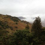
On Saturday morning I met the group in Buttermere, and after a few minutes of finalising kit we were on our way (8.17am). The start of the challenge is not a kind one as we got straight into the climb by heading up the steep steps leading to Red Pike. We made great progress up this steep climb, despite intentionally taking it easier as to not burn out. After the final scramble we were on the summit of Red Pike after 1 hour and 20 minutes. There was a bit of mist on the Buttermere Fells but there was more over towards Great Gable where we would be heading later.
From Red Pike we followed the ridge and a short climb brought us up to summit number 2, High Stile. From High Stile another ridge walk brought us quickly onto summit 3, High Crag. With 3 summits in the bag within a couple of hours we now had a large descent to deal with. We descended the steep slope of Gamlin End before heading across Scarth Gap. From here we scrambled quickly up the slope to the summit of Haystacks, unfortunately not one of the 24 peaks!
We headed south from Haystacks past Inominate Tarn and weaved our way around the many tarns and outcrops before joining the track that climbs up to the Moses Trod Path. We joined this path for a short while before cutting off to hoin the northern slope of Green Gable. A short drag up into the mist brough us summit number 4, Green Gable. Great Gable soon followed as we headed across windy gap and up over the boulders to its windswept summit. We didnt linger long as we were planning on having Lunch at Styhead pass. We reached Styhead Pass after the knee crunching descent and the break was very well received!
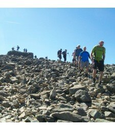
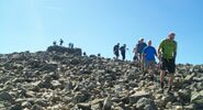
After the break we were back on the ascent and we made our way up the Corridor Route to the summit of Lingmell. We were still climbing really well and focused on now reaching the highest summit in England. The group continued to climb well and after about 20 minutes we were on the summit of Scafell Pike. We were lucky enough to have some views so we took a moment to soak them up before heading onto our next peak. We crossed Broad Crag Col follwed by Broad Crag and Ill Crag before a short ascent brought us up to Great End. We continued with great pace across Esk Hause and summited Esk Pike shortly after. 9 down, 1 to go. We crossed Ore Gap and picked our way through the boulders and onto the summit of Bowfell.
With all of Day 1's peaks done we now just had to descend, and we had 1 hour 30 to get to the bottom to do it in 12 hours. We descended to the Three Tarns before turning east and joining The Band. We walked very quickly down the good path and we got to the bottom at about 12 hours exactly!
The alarm clock went off way too soon on Sunday morning, but we had some unfinished business to attend to, so out of bed we had to get! Unfortunately 3 of the 10 were unable to continue onto day 2 of the challenge.
After meeting in Ambleside at 7am we got our lift to the Kirkstone Pass, a great place to start the second day as its 350m above sea level. However, despite having a head start the first slope up Red Screes was by no means an easy one. We set off and the sun was already breaking through the patchwork of clouds, it was looking like a good day. We actually made amazing progress up this steep slope and we were on the summit after just 35 minutes.
We took a few minutes to have a breather on the summit, but then we made our way across the grassy slopes to Dove Crag. Hart Crag and Fairfield followed soon after. With just over 2 hours gone we were now on the toughest section of the day. We descended down the steep western side of Fairfield before climbing the very steep slope on the side of Seat Sandal. From this summit we had to descend straight away. Back in the col we chose to take the steep runners path up to the summit of Dollywagon Pike, this was hard work, but once again the group climbed well.
We were now onto the easier section of the walk and the summits would start to come much quicker. After Dollywagon Pike we took in Nethermost Pike, Helvellyn, White Side and Raise. We had just 3 summits left and we seemed to be walking better than ever. It had been windier across these last few summits, but the sun was starting to come out again. We cracked on to the Dodds, and we had soon taken in Stybarrow Dodd, Great Dodd and our final summit, Watson's Dodd. We had done it, all we had to do was descend down to the roadside.
We descended down the grassy slope towards Castle Rock, and after passing the rock face we had made it to the roadside. John met us at the bottom and produced some champagne to celebrate our success. We had managed to complete the second day in just 8 hours 20 minutes, brining our total time to 20 hours and 20 minutes! Well done Chaps!!


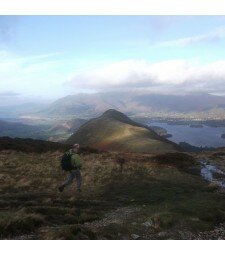
 Towards the Scafell and Great Gable range
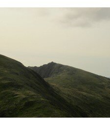
 Towards the Scafells from Dove Crag
 The Coniston Fells, The Crinkles and Bowfell from the climb up Nab Scar
 Looking over Rydal Water from Nab Scar
 Windermere from Nab Scar
 Red Screes
 Over Windermere
 Grasmere
 Windermere from Hart Crag
 Dove Crag
 The view down Rydal
 The view down Rydal
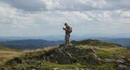
 On Hart Crag
 On Hart Crag
 On Hart Crag
 Back towards Heron Pike