Welcome to The Lake District Walker
Shopping Cart - £0.00

You have no items in your shopping cart.

Return to Previous Page
    • Please specify the product's required option(s).
High Raise

High Raise from Borrowdale: Private Guiding

Be the first to review this product

£100.00
Product code: 61

Availability: In stock

  • Book a group of 2 for £60.00 per person
  • Book a group of 3 for £40.00 per person
  • Book a group of 4 for £35.00 per person
  • Book a group of 5 for £28.00 per person
  • Book a group of 6 for £27.00 per person
  • Book a group of 7 for £23.00 per person
  • Book a group of 8 for £20.00 per person
  • Book a group of 12 for £19.00 per person
  • Book a group of 16 for £18.00 per person
  • Book a group of 24 for £16.00 per person

Quick Overview:

High Raise is the highest of the Central Fells, and a wonderful viewpoint over almost all of the Lake District, this guided walk climbs High Raise from Stonethwaite in the Borrowdale Valley.
More information...
Select Date

* Required Fields

£100.00
Add to Cart
Add to Compare
Add to Wish List
Alternatively...

Details

Difficulty: Moderate / Hard
  A few steep climbs but little exposure
Distance: 15km / 9 miles approx.
Ascent: 1280m / 4200ft approx.
Time: 7 hours
Start Time: 10am
Maximum Group Size: 10
Minimum Group Size: 1


"This is a beautiful fell, often admired, seldom ascended."
A.W Wainwright on Eagle Crag

High Raise, the highest of the Central Lake District Fells is rightly a popular summit, but the Borrowdale side of the mountain is much less trodden than the routes above Langdale and Grasmere to the south and east.

The ridge climbing above Stonethwaite from the Borrowdale Valley over Eagle Crag and Sergeant's Crag offers a wonderful route climbing between crags to the summit of Eagle Crag before following the ridge over Sergeant's Crag where a grassy slope leads to the summit of High Raise.

The descent from Ullscarf also gives a peaceful descent, over heathery slopes as we descend by the beautiful Dock Tarn.


Summits included on this route:
   
Eagle Crag
520 metres/1706 feet
Sergeant's Crag
571 metres/1873 feet
High Raise
762 metres/2500 feet
Ullscarf
726 metres/2382 feet
Great Crag
440 metres/1444 feet


"Hereabouts the surround of mountainous country is complete, the western arc being occupied by a tumultuous skyline and the eastern horizon formed of lofty smooth ranges."
A.W Wainwright

From Stonethwaite we climb the north western spur of High Raise, a wonderful route winding between crags to the summit of Eagle Crag, a great viewpoint over Stonethwaite and the southern reaches of Borrowdale.

The ridge south from Eagle Crag brings us to Sergeant's Crag before a grassy slope gives us a gentle climb to the summit of High Raise, the highest of the Central Fells and a wonderful viewpoint of the higher mountains of the Lake District.

From the summit of High Raise we will follow the path north, descending to Greenup Edge before climbing again to the summit of Ullscarf.

We will descend the north western spur of Ullscarf, a delightful heather covered ridge with barely a path to be seen, this ridge will bring us down to the picturesque Dock Tarn and the nearby summit of Great Crag.

The descent east from Great Crag will bring us back to Stonethwaite.

Each participant will be required to bring suitable equipment for their chosen event, please see Equipment Required.


Where to meet: Stonethwaite, Borrowdale
View Larger Map
Postcode: CA12 5XQ
Grid Reference: NY 263 136

Directions

From Keswick:
Leave on the Borrowdale Road (from the mini roundabout near the co-op) Follow this road for several miles, passing through the village of Rosthwaite, Continue on this main road until you reach an 's' bend on which is a left turn signposted Stonethwaite and The Langstrath Inn. Park just before the village on this road and walk in. We will meet outside The Langstrath Inn.

Write Your Own Review

Only registered users can write reviews. Please, log in or register

Product Tags

Use spaces to separate tags. Use single quotes (') for phrases.

  • High Raise

    A spectacular day in the Lakes today, wall to wall sunshine and clear views.

    From Grasmere we climbed onto Silver How and followed the ridge towards Blea Rigg, seeing a grass snake sunning itself on the path, the first I have ever seen n the fells!

    After a short lunch stop on the summit of Blea Rigg we continued toward the summit of Sergeant Man, a great little rocky summit and walked over to High Raise, with wonderful panoramic views of the lakeland fells. There was cloud blowing over the Scafell Range (the group up there just caught the cloud as they reached the summit).

    We descended over Tarn Crag and down to Easdale Tarn, it is amazing how dry everything is this year already.

    From Easdale we followed the path down by Sour Milk Gill back to Grasmere.

  • Navigation Training on Silver How

    Another days navigation training today, climbing from Chapel Stile we made our way along the Silver How ridge with several excersises on route before descending back to Chapel Stile by Meg's Gill.

  • Navigation Training on Silver How

    A good day despite heavy showers today on Silver How, we climbed from Elterwater onto the ridge above High Close Youth Hostel and undertook several navigation excercises along the ridge and over Silver How and above Blindtarn Moss before descending down to Chapel Stile and Elterwater.

    Strong wind and a few heavy showers in the early afternoon made the conditions interesting for a little while.

  • Silver How Navigation Training

    A good day above Elterwater today practising navigation skills.

    We climbed from the village onto the ridge above High Close before following the ridge to eventually have lunch on the summit of Silver How with a magnificent view over Grasmere and Rydal Water.

    After lunch we continued along the ridge towards Blea Rigg before doubling back on ourselves and descending by Megs Gill back down to the Valley at Chapel Stile and walking back alongside the river to Elterwater.

  • High Raise

    A good day above Grasmere today following the ridge from Silver How over Blea Rigg to Sergeant Man and High Raise before descending over Tarn Crag to Easdale Tarn and back down to Easdale and Grasmere.

    The weather held off all day for us and the winds were light and we had good views all day except around Codale Head where the cloud descended on us but we were soon out of this as we descended towards Tarn Crag.

  • Silver How Navigation Training

    A cold day on Silver How with a Navigation Training Course today.

    From Elterwater we climbed onto the ridge above High Close and ran several navigation exercises along the ridge over Silver How and as far as Blea Rigg.

    There was a strong northerly wind all day and it was very cold in the wind, there were occasional snow showers during the day, but there were some great views of the higher fells surrounding us.

    We descended by Meg's Gill to Chapel Stile and followed the river path back to Elterwater.

  • Silver How – Navigation Trining

    A good days Navigation Training on Silver How today.

    We set off from Elterwater and climbed above the High Close Youth Hostel and ran several exercises between her and the summit of Silver How, stopping for lunch just below the summit of Swinescar Pike.

    We continued a little further along the ridge towards Blea Rigg before doubling back and descending by Megs Gill down to Chapel Stile and following the river back to Elterwater.

  • Silver How - Navigation Training

    A great day on Silver How today with a Navigation Training Course.

    We set off from Elterwater at 10am and climbed onto the Silver How Ridge above High Close and followed the ridge over Silver How and along to Swinescar Pike running several navigation exercises along the way, descending to Chapel Stile by Megs Gill and following the river back to Elterwater.

    A fantastic day with some great views throughout.

  • Silver How Navigation Training

    Navigation Training today on Silver How, the weather wasn't great with low cloud and drizzle pretty much all day but we had  good day following the ridge from above Red Bank along over Silver How to Swinescar Pike, with several navigational exercises along the way.

    We descended by Megs Gill and Thrang Crag to Chapel Stile and followed the riverside path back to Elterwater.

  • Silver How - Navigation Training

    Wonderful weather today on Silver How for a Navigation Training day. We sett off from Elterwater in bright sunshine and climbed onto the ridge above High Close and ran several navigation exercises along the ridge to Megs Gill before climbing to the summit of Silver How.

    We stopped for lunch on Silver How to admire the view over Grasmere and Rydal Water, without a breath of wind, before continuing along the ridge by Lang How and Swinscar Pike, descending by Megs Gill to Chapel Stile and back along the river to Elterwater.

  • Silver How Navigation Training

    A near perfect day again today on Silver How for a Navigation Training Course, we set off from Elterwater at 10am and climbed above Red Bank onto the Silver How Ridge near Dow Bank, running several navigation exercises along the ridge to reach the summit of Silver How for lunch.

    After lunch we continued west along the ridge as far as Swinescar Pike before returning to descend to Chapel Stile by Megs Gill and following the river back to Elterwater.

  • NNAS Silver Course

    Two great days running a navigation course. Day one was spent on Silver How and on day two we negotiated lumps, bumps and tarns on Loughrigg Fell.
    The weather was fantastic throughout.

  • GPS Training

    A good day above Elterwater today with a GPS Training Course.

    After a short trip around the woods on the lower slopes of Lingmoor Fell we headed up onto the slopes of Silver How practising several techniques with the GPS units before descending to Chapel Stile and back along the river to Elterwater.

  • NNAS Silver Navigation Course

    Great weekend running a Silver NNAS course. Based at Elterwater, day one was spent on Silver How running various navigation exercises. Day two was spent on Loughrigg Fell, navigating our way around lumps, bumps, tarns and ponds.

  • High Raise from Grasmere

    A wonderful day today climbing High Raise from Grasmere, we set off at 10am and climbed by Allan Bank to the summit of Silver How with wonderful view over Grasmere and Rydal Water.

    From Silver How we followed the ridge west, climbing over Blea Rigg to Sergeant Man, stopping on the summit of Sergeant Man for lunch.

    After lunch we climbed the short slope to the summit of High Raise, a wonderful panoramic view from the summit before descending the rough ridge to Tarn Crag and down from the crag to Easdale Tarn.

    We returned to Grasmere by Sour Milk Gill  and along the Easdale Valley.

  • Navigation Training Silver How

    A good days Navigation Training on Silver How today, once again with some wonderful weather.

    We set off from Elterwater at 10am and ran several navigation exercises above High Close and along the ridge to the summit of Silver How where we stopped for lunch.

    After lunch we continued west along the ridge with several more practical exercises before descending by Meg's Gill to Chapel Stile and following the river back to Elterwater.

  • Silver How Navigation Training

    A great day on the Silver How ridge today with a Navigation Training course.

    Setting of from Elterwater at 10am we climbed onto theridge above High Close and followed the ridge over Dow Bank to Silver How, running several navigation excercises on the way to the summit.

    After lunch we continued along the ridge past Swineside Pike before descending to Chapel Stile and following the river back to Elterwater.

  • Silver How Navigation Training

    A great day on the Silver How ridge today on a Navigation Training Course. The near perfect weather made it an enjoyable day as we climbed from Elterwater above High Close and followed the ridge west running several navigational exercises as we crossed Silver How to Swinescar Pike.

    We returned from Swinescar pike to descend to Chapel Stile by Megs Gill before following the river back to Elterwater.

  • Silver How Navigation Training

    A good day on Silver How today with an Navigation Training Course.

    From Elterwater we climbed above High Close and followed the ridge over Dow Bank to the summit of Silver How running several navigation exercise on the way to Silver How.

    On and off drizzle persisted for much of the morning, although after lunch this got a little heavier for a while it was much better than expected! After a short lunch stop on the summit of Silver How we continued west along the ridge exploring the area around Swinscar Pike.

    We descended to Chapel Stile by Thrang Quarry and followed the river back to Elterwater.

  • High Raise from Grasmere

    Another fantabulous day walking in the late summer sun!

    I met Joan in Grasmere ready to tackle High Raise. We climbed out of Grasmere up onto Silver How and were quickly feeling the heat of the sun. As we got to the top we were greeted with stunning 360 degree views of the surrounding fells, as well as being able to see our entire route for the rest of the day. At this point Sergeant Man looked like it was miles away (technically it was, but it looked like a proper mission! haha) We made our way over the undulating ground up towards Swinescar Pike, followed by Blea Rigg. From here we had another short section of flat ground before we started the toughest ascent of the day up onto the summit of Sergeant Man. On the summit we gained fantastic views over the Langdale Fells, Coniston Fells and even the Scafell Massif. We were both ready for lunch, but I was keen for Joan to see the amazing views that High Raise had to offer, so we pressed on and after just a few minutes we were looking down over Borrowdale from the summit.

    After our lunch stop we retraced our steps slightly and then headed down towards Tarn Crag. We reached Tarn Crag and started to descend the final sections of the day in the gorgeous afternoon heat. We were soon back on flat ground and on our way back into Grasmere.

  • High Raise from Grasmere

    Another great day above Grasmere today, this time a longer route climbing to High Raise and then descending over Helm Crag.

    We set off from Grasmere at 9am and climbed onto Silver How. There was some mist in the valley and the views were magnificent. After a short stop on the summit we pressed on, following the ridge climbing past Blea Rigg and climbing to Sergeant Man.

    From Sergeant Man we crossed to the summit of High Raise, stopping for our lunch in one of the summit shelters to eat our lunches.

    After Lunch we descended by Mere Beck and crossed to the summit of Calf Crag flown the ridge over Gibson Knott to Helm Crag.

    From Helm Crag we descended to Easdale ad followed the lane back into Grasmere.

  • Silver How Navigation Training

    A damp day on Silver How with a Navigation Training Day.

    We set off from Elterwater at 10am and climbed above High Close making our way to the summit of Silver How running several navigation exercises on the way.

    After a short lunch stop on the summit of Silver How we continued to follow the ridge west crossing to Swinescar Pike and continuing as far as Raw Pike before returning by Sheep Crag and descending by Megs Gill to Chapel Stile and following the river back to Elterwater.

    A good day, although a little damp and windy at times!

  • Silver How and Blea Rigg

    A wonderful day above Grasmere today, we set off from Grasmere just after 10.30am and climbed by Allan Bank, now with it's new roof, and followed the path up by Wray Gill to Brigstone Moss, climing to the summit of Silver How.

    The views were great today, nothing distant, but the views over Grasmere and Windermere were magnificent.

    We followed the ridge west climbing onto the summit of Lang How to stop for lunch.

    After lunch we continued along the ridge, over Swinescar Pike and up to Blea Rigg before descending by Easdale Tarn and Sour Milk Gill back down to Easdale and Grasmere.

  • Silver How Navigation Training

    A good days Navigation Training on Silver How today.

    We climbed from Elterwater and climbed above High Close onto the ridge and ran several navigation exercises along the ridge by Dow Bank and up to the summit of Silver How, stopping on the summit of Silver How for lunch and continuing after lunch along the ridge by Swinescar Pike before returning along the ridge to descend to the west of Megs Gill and down to Thrang Crag Quarries and Chapel Stile following the river back to Elterwater.

  • Silver How Navigation Training

    Perfect weather today as we headed up onto Silver How for a Navigation Training Day, Peter and I headed out from Elterwater just before 10am and climbed above High Close onto the Dow Bank ridge running several navigation exercises along the ridge before climbing to the summit of Silver How and then along the ridge to Swinescar Pike.

    After lunch we descended by Megs Gill and down to Thrang Quarries walking back by the river from Chapel Stile back to Elterwater.

    A wonderful day with some amazing views.

  • Silver How Navigation Training

    Day 1:

    I met Robin outside the Brit Inn in Elterwater this morning, and before we made our way towards the fells we sat on the benches and ran through some basics. After covering Grid References, scales, contours and map symbols we got on our way. We slowly worked our way up past Dub How and towards Silver How via multiple navigational legs, each time adding new techniques such as pacing and timings. At the bottom of Megs Gill me had a spot of lunch and enjoyed the stunning views (another great November day!). After lunch we moved onto bearings, stressing their effectiveness when done correctly. Robin picked up bearings extremely quickly, and with great accuracy so we continued to build on overall navigational tactics, combining everything we had learnt previously. After a few more legs we decided to turn back towards Elterwater and enjoy a leisurely walk back to the cars.

  • Navigation training

    Day 1:

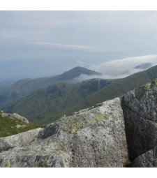
    I met Catherine in Elterwater, and before we got going we discussed Catherine's current standard of navigation. After just a short chat with Caroline she clearly had enough knowledge to cover the basics such as grid references, map symbols etc so she wanted to focus on techniques such as bearings, and what to do when in thick mist. Taking all this into mind we headed straight for the fells. Along the way we covered pacing and navigational technique and before long we were up by Dub How. From here we could see Helvellyn with a blanket of snow on it, Winter is here!

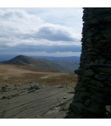
    We spent most of the morning covering short navigational legs and focusing on distance, timing and pacing. Shortly after midday we had a spot of lunch and then focused on bearings. We got cauight in a hail storm and we both frantically threw on more layers. After the hail storm had passed we noticed Fairfield and its surrounding peaks were now covered snow too! We spent the next couple of hours using bearins and utilising all the techniques we had covered over the course of the morning.

    Day 2: Another clear morning in Elterwater today, with the higher fells in view holding more snow than yesterday!

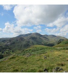
    We focussed our navigation over towards Lingmoor Fell and after a couple of 'warm up' legs to refresh what was learnt yesterday, we continued some more complex legs, taking in all the techniques learnt. Catherine was navigating extremely well, so I progressively made each leg harder. We spent a lot of time on contour interpretation of which Catherine also grasped extrmely well. We also spent some time working on the 1:50,000 maps to test the same skills on a different scaled map. We finished the day just as a long shower was setting in and got back to Elterwater after another great day out! Congratulations to Catherine who also passed her NNAS silver award over the course of the two days!

  • Silver How Navigation Training

    A fantastic day on a navigation course, on a very wintry Silver How!

    I met ray, an aspirant ML in Elterwater, and after having a quick chat we were soon on our way up onto the fells. Ray was joining us on a navigation course to refresh his skills, as well as to learn some of the more technical elements such as contour interpretation. We climbed onto the undulating ground below Silver How and worked our way up onto the snow via Megs Gill. In places we were really exposed to the wind, which mixed with the falling snow made for some interesting conditions to navigate in!  Above about 350m we were walking on snow but these very wintry conditions did not phase Ray as he continued to navigate extremely well. We focused much of the day on contour interpretation, comparing the map to the ground and focusing on the intricate features. We got off the hill just before nightfall, slightly damp, but both having had a great day out on the fells.

  • Silver How Navigation Training

    A truley beatiful day out on the fells today!

    I met the Brendan, Ian and 12 year old Will at the Britania Inn, and all being self-procalaimed novice navigators we started from scratch. To start we covered Grid references, Map features, symbols and finally map orientation. The fells were beckoning so we got on our way. On our way up towards Dub How we covered pacing, handrails and a small amount of contour interpretation. Feeling a bit hungry we found a great lunch spot in the sun and enjoyed our sarnies with fabulous views of the Coniston Fells standing proud under a white blanket.

    We spent most of the afternoon working our way towards the summit of Silver How consolidating all the skills we had already covered, and then bearings. The summit plateau was very snowy and great fun to be walking on! We took a nice gentle stroll off the hill and enjoyed the views. A great day out, and Ian and Will will be out navigating with us again tomorrow!

  • Navigation Training Course

    Another great day on a navigation training course today! I met Chris in Elterwater and as usual started off by discussing his current navigational abilities. Chris had done map work previously and is a very keen walker, so wanted to be taught some of the grittier techniques such as pacings and bearings. We got on our way up towards Dub How, doing navigational legs on the way covering some of the basics such as handrails and catchment features. We spent the morning making our way up to the higher ground where it is better for bearing practice, and after walking up by Megs Gill we had a quick spot of lunch. Now up over the snow line, in the mist, plus the rain (which hadn't stopped all day!)  we had some perfect conditions for some tough nav practice. We spent the next couple of hours running nav legs which got progressively harder, starting with tarns then moving onto smaller contour features. Chris navigated exceptionally well and had obviously grasped the techniques. We took a nice stroll off the hill, just as some of the mist cleared to give some nice views down to Elterwater.

  • Silver How Navigation Training.

    I met Claire in Elterwater and we started off by discussing her previous experience with a map and compass. Claire told me that in the future she hopes to lead walking groups, so coming and working towards her Silver NNAS Award is a great way to start!

    We discussed Grid References, map symbols contours and orientation before setting off towards the fells. We completed multimple Nav legs as we made our way towards Silver How, each time covering something new such as Pacing or timing. After finding our usual hidden sheepfold we sat and enjoyed some lunch, along with the views as it was a glorious day! After refuelling we ran through bearings and spent the afternoon putting everything taught throughout the day into practice. We finished the day with a nice gentle stroll off the fells enjoying the weather.

  • Silver How Navigation Training

    A great day above Elterwater today with a Navigation Training Course.

    We set off from Elterwater at 10am and climbed above High Close, following the ridge west climbing eventually by Meg's Gill to the summit of Silver How. After a short lunch stop on the summit of Silver How we continued west running several navigation exercises as far as Swinescar Pike before descending by Thrang Crag to Chapel Stile and following the river back to Elterwater.

  • Silver How Navigation Course

    Wow, what an amazing day to be out on the fells! Not a breath of wind, clear blue skies, nice temperature, and snow capped fells all around...Magic!

    I met Mark, Carole and Jess (the Dog) in Elterwater and after covering Grid references, map symbols and orientation we got cracking towards Silver How. The ground was hard in most places, but now snow down to the roadside. We covered pacing, timing and following the map whilst slowly making our way towards the summit. We had a spot of lunch and enjoyed the amazing views before covering bearings in the afternoon.

  • Silver How Navigation Training

    A grey day today as we headed up onto Silver How for a Navigation Training day.

    A little rain had fallen this morning onto frozen ground making it a little slippery underfoot and once we were up onto the ridge we spent most of the day wearing crampons!

    We climbed above High Close before running several exercises over the summits of Silver How and Swinescar Pike before heading back along the ridge to Down Bank and descending back down to Elterwater.

    Mark did really well in some tough conditions today, at times it was near white out!

  • Silver How Navigation Training

    Day one of a two day navigation course today and Silver How was our destination. Meeting outside the Brit Inn in Elterwater we ran through some map based information such as Grid References, symbols and orientation. Not before too long we started to make our way up onto the fellside. The weather was glorious, with blue skies, crisp views and even a bit of heat from the sun! (Such a contrast from yesterday its mad!) As we worked our way up towards Silver How we covered Handrails, Catchment features, timings and pacings.

    Our lunch break was great. We sat and admired the views and even had a few fly pasts from RAF helicopters and Jets. We sent the afternoon focusing on bearings, as well as taking in the summit of Silver How. Martin and Anne navigated well today and took on everything very quickly. Up onto Lingmoor Fell tomorrow for some more practice and an NNAS Assessment.

  • High Raise from Grasmere

    Another fantastic day out taking in High Raise from Grasmere.

    Starting from an already warm Grasmere we headed out of town and towards Silver How, the lovely little fell that overlooks the village. We climbed slowly up the fellside, firstly up a little lane and then out into the open land. Not before too long we had made our way up onto the summit of Silver How, a remarkable little summit with great views. From here we could see most of our route, with Sergeant man standing far in the distance.
    Our route was now over undulating terrain, which climbed slowly towards Blea Rigg. Along the way we had great views of The Langdale Pikes. As we reached Blea Rigg we had a small bite to eat before continuing up to Sergeant Man. The summit of Sergeant Man was like Butlins when we arrived, just without the towels! We stopped here for a lunch stop before continuing the short distance to High Raise. The views from High Raise are also spectacular, what it it being the highest of the central fells, you get a 360 degree view of pretty much all the lakes.

    We now started our return journey and started our descent over Tarn Crag. The long spur that stands high over Easdale tarn makes an enjoyable route down. We enjoyed the afternoon heat along the way and back into Grasmere. A fantastic day in the central fells.

  • Silver How from Grasmere

    A short afternoons walk from Grasmere today climbing Silver How.

    We set off from the village at 1.30 and climbed by Allan Bank up the slopes to the summit of Silver How, meeting with some of the Workington Ramblers on the summit.

    The views from the summit were great, we decided to follow the ridge a little and descend back to Grasmere from Lang How.

  • Silver How Navigation Training

    A great day running a Navigation Training Course on Silver How.

    After discussing Christine's current navigational abilities outside the Britannia Inn in Elterwater we made our way up onto the fellside. Along the way we ran through multiple techniques such as handrails, catchment features, countour interpretation, pacing and timings. Christine navigated very well all morning and was utilising each new technique every time. After a spot of lunch we spent the afternoon running through bearings, and then adding in the pacings with them.

  • Silver How Navigation Training

    A great day on Silver How today with a  Navigation Training Course.

    We set off from Elterwater at 100am and climbed above Red Bank and ran several navigation exercises, stopping for lunch on the summit of Silver How before continuing to Swinescar Pike and returning along the ridge to Dow Bank and descending back to Elterwater for a well deserved drink at the Britannia Inn.

  • Silver How Navigation Training

    A good day on Silver How today with a Navigation Training Course.

    Although the weather was a little dam we climbed above Red Bank and ran several exercises along the ridge to the summit of Silver How, stopping for lunch just below Lang How before continuing along the ridge over Swinescar Pike.

    The rain got a little heavier through the afternoon but we pressed on, following the ridge back to Dow Bank before descending to Elterwater.

  • High Raise from Borrowdale

    A scorching day on the route that is High Raise from Borrowdale.

    After meeting in Stonethwaite we got on our way up the valley next to Stonethwaite Beck. Eagle Crag, our first objective of the day was standing high in the centre of the valley, and with its sheer sides it looked quite daunting! Instead of taking the steep line up the front of Eagle Crag we contoured around its side and took an easier slope up towards its summit. It was already baking hot, and it wasn't even half 10! We got to the summit and enjoyed the amazing views. From the summit we walked the short distance along the grassy spur to our second, slightly higher summit of Sergeants Crag. From this rocky summit we continued along the grassy spur. As everyone had been to High Raise before, and as it was soo hot we opted to not head up to its summit, and instead we cut along the top of Long Crags and made our way towards Ullscarf. On the way we stopped and had a bite to eat, during which a Hercules flew right over our heads.

    After lunch we followed the long grassy slope up to the flat top of Ullscarf. From here we headed to the north, over High and Low Saddle to Dock Tarn. We picked our way through the heather over the lumps and bumps to the summit of Great Crag. With four more Wainwrights ticked for Suzanne's list we descended down the steep path through the woods and back into Stonethwaite.

  • Silver How Navigation Training

    A good day on Silver How today with a Navigation Course.

    From Elterwater we climbed above High Close and ran several navigation exercises along the ridge, stopping for lunch on the summit of Silver How before continuing as far as Swinescar Pike before returning along the ridge to Dow Bank and back down to Elterwater.

  • Eagle Crag & Sergeant's Crag

    A great afternoons walk above Stonethwaite today climbing Eagle Crag and Sergeant's Crag before descending by Greenup Gill back to Stonethwaite.

    We set off from the Langstrath Inn at 2pm and followed the path alongside Stonethwaite Beck and climbed the nose of Eagle Crag, a steep start but this eased as we climbed higher, zig-zagging above Heron Crag to the summit of Eagle Crag.

    There were some great views from the summit, all the high tops were out of cloud, although there was some dark cloud moving in from the south which soon enveloped the highest tops.

    After a short break on the summit we continued, crossing along the ridge to the the summit of Sergeant's Crag and after a short stop here we descended south east into the valley below Lining Crag, admiring the wonderful Glacial Moraines here before crossing to meet the path descending by Greenup Gill and down to Stonethwaite.

  • Navigation Training Silver How

    A good day on Silver How today on a Navigation Training course.

    We set off from Elterwater at 9.30am and climbed above High Close onto the Dow Bank ridge, running several excercises along the ridge to Silver How and then as far as Swinescar Pike before returning along the ridge as fae as Down Bank and then back down to Elterwater.

    A few showers today, but we seem to have got off lightly compared to others.

  • High Raise from Grasmere

    A great day out today above Grasmere climbing High Raise.

    The weather this morning was great, cold but very bright and clear as we set off from Grasmere village, climbing up by Allan Bank and Wray Gill to the summit of Silver How.

    As we followed the ridge from Silver How by Lang How and Swinescar Pike towards Blea Rigg we were rewarded with some wonderful views as far as Blackpool to the south, Scotland to the north and most of the Lake District fells around us.

    We stopped for lunch just behind the summit rocks of Blea Rigg with a wonderful view over Langdale and to the Old Man of Coniston to the south before continuing to climb the ridge to the summit of Sergeant Man where after a short stop we continued up onto the summit of High Raise.

    The views from the summit were spectacular but after a long stop we pressed on, crossing to Codale Head before descending east above Lang Crag to the summit of Tarn Crag.

    From Tarn Crag we followed the path east dropping down into Far Easdale and crossing the bridge by Stythwaite Steps before following the valley track back to the Easdale Road and into Grasmere.

  • Silver How Navigation Training

    A blustery day on Silver How with a navigation training course.
    We set off from Elterwater at 10am and climbed up by Huntingstile Crag and onto the ridge by Dow Bank, running several excercises to the.summit of Silver How.
    By the time we were on the summit of Silver How the wind was getting quite strong and blowing the showers in quickly, we went as far as Lang How before returning by Megs Gill and following the Langdale Beck back from Chapel Stile to Elterwater.

  • Silver How Navigation Training

    A good day on Silver How today with a Navigation Training Course.

    We set off from Elterwater just before 10am and climbed up onto the ridge by Dow Bank, stopping off at plenty of 'lumps and bumps' on the way to the summit of Silver How.

    We stopped for lunch on the summit of Silver How and continued west picking out plenty of features as far as Swinescar Pike before picking a route back by Megs Gill and Dow Bank to Elterwater.

  • Night Navigation Training

    We had a pleasant evening today on the lower slopes of Silver How with a Night Navigation Course.

    We  set off just before 7pm from Elterwater and by the time we were near the Hammerscar Plantation it was dark.

    We spent four hours picking out plenty of the 'lumps and bumps' and streams along the Dow Bank and Spedding Crag ridge before returning to Elterwater just after 11pm.

  • Silver How Navigation Training

    A glorious day on Silver How today with a Navigation Training Course.

    From Elterwater we headed up onto the Silver How ridge near Dow Bank and ran several navigation exercises along the ridge over the lumps and bumps to the summit of Silver How.

    After lunch we continued west along the ridge as far as Swinescar Pike before returning to Elterwater by Megs Gill and Spedding Crag.

  • Night Navigation Silver How

    A good evening today on the lower slopes of Silver How.

    We spent several hours around Dow Bank and Spedding Crag picking out plenty of 'lumps and bumps' before returning to Elterwater at at about 11pm.

  • Navigation Training on Silver How

    A good day on Silver How today with a Navigation Training Course.
    We set off from Elterwater at 10am and climbed above High Close and up onto the ridge below Dow Bank.
    We picked out plenty of lumps and bumps along the ridge to the summit of Silver How and then along to Swinescar Pike before returning by Megs Gill and Dow Bank dropping back down to Elterwater.

  • Navigation Training on Silver How

    A great day on the Silver How ridge today with a Navigation Training Day.

    We set off from Elterwater just after 10am and climbed above High Close onto the Dow Bank ridge, running several navigation exercises along the ridge to Megs Gill and then up onto the summit of Silver How.

    We stopped for lunch by the summit cairn of Silver How before continuing along the ridge as far as Swinescar Pike before returning by Megs Gill and Dow Bank to Elterwater.

  • Silver How from Grasmere

    A wild day above Grasmere today.

    The forecast for today was foul, but as we set off from Grasmere this morning the winds were light and there was little more than light drizzle in the air.

    We climbed by Wray Gill and up to the summit of Silver How in good time, by the time we were on the summit of Silver How the rain had intensified a little, still not too bad though.

    As we followed the ridge from Silver How past Lang How and Swinescar Pike the wind got stronger and stronger and by the time we were approaching Blea Rigg we decided to head down by Easdale Tarn and back to Grasmere.

    We dropped down to the tarn and out of the mist and followed the path by Sour Milk Gill down to Easdale and the track back to Grasmere.

    A little shorter than the day we had planned but still an enjoyable one!

  • A wild day on Silver How

    We set off from Elterwater at 10am today with a little snow on the ground, but a poor forecast and headed up onto the Dow Bank Ridge, taking the path below the summit of Dow Bank and following the ridgeline up onto the summit of Silver How.

    The weather was getting worse as we climbed to the summit and at the summit it was wild, we soon decided not to head along the ridge any further towards Swinescar Pike and instead dropped down by the upper section of Megs Gill, getting a little shelter out of the wind and following the ridge back towards Dow Bank and taking the path back to Elterwater.

    Despite the difficult conditions we had a good few hours.

  • Silver How Navigation Training: Monday 25th February 2013

    A days Navigation Training Course on the Silver How ridge above the Langdale Valley in near perfect conditions.
  • Navigation Training on Silver How

    A day of navigation training on Silver How from Elterwater.
  • High Raise from Grasmere

    A fantastic day walking up from Silver How onto High Raise and down to Grasmere
  • High Raise from Grasmere

    A good day climbing above Grasmere to High Raise, taking in the summits of Silver How, Blea Rigg, Sergeant Man and Tarn Crag then descending by Easdale Tarn.
  • 77 Peak Challenge Day 7: The End is in Sight

    A glorious day to round off our 77 Peak Challenge, today we walked from Grasmere over Helm Crag to High Raise and the Langdale Pikes descending to Langdale.
  • Navigation Training

    A great 2 days of Navigation Training from Elterwater on Silver How and Lingmoor Fell.

Community Feedback