Welcome to The Lake District Walker
Shopping Cart - £0.00

You have no items in your shopping cart.

Return to Previous Page
    • Please specify the product's required option(s).
The Scafell range from Haycock

Above Ennerdale to Caw Fell: Private Guiding

Be the first to review this product

£100.00
Product code: 26

Availability: In stock

  • Book a group of 2 for £60.00 per person
  • Book a group of 3 for £40.00 per person
  • Book a group of 4 for £35.00 per person
  • Book a group of 5 for £28.00 per person
  • Book a group of 6 for £27.00 per person
  • Book a group of 7 for £23.00 per person
  • Book a group of 8 for £20.00 per person
  • Book a group of 12 for £19.00 per person
  • Book a group of 16 for £18.00 per person
  • Book a group of 24 for £16.00 per person

Quick Overview:

The fells above the Ennerdale Valley give some wonderful walking in one of the most remote areas of the Lake District.
This guided walk includes the summits of Caw Fell and Haycock before a return trip along the Ennerdale lakeshore.
More information...
Select Date

* Required Fields

£100.00
Add to Cart
Add to Compare
Add to Wish List
Alternatively...

Details

Difficulty: Hard
  A steep climb at times but no exposure
Distance: 22km / 14 miles approx.
Ascent: 990m / 3300ft approx.
Time: 7 hours
Start Time: 10am
Maximum Group Size: 10
Minimum Group Size: 1


"The fell, indeed, has all the qualities of ruggedness and cragginess characteristic of the Wasdale mountains, and the approaches to it have charm of surroundings not usually associated with such rough terrain."
A.W Wainwright

The high ground to the south of Ennerdale is some of the most remote and least visited in Lakeland, this route, from the shores of Ennerdale Water climbs four of the mountains in this area, the lower summits of Crag Fell and Grike before climbing over the huge expanse of Caw Fell, the huge rolling ridge climbing high above Ennerdale towards the higher fells of Wasdale.

The ridge leads east from Caw Fell to climb to the rocky summit of Haycock, from the summit of Haycock we will descend north to the Ennerdale Valley to the shores of Ennerdale Water following the shoreline back below Anglers Crag.


Summits included on this route:
   
Crag Fell
523 metres/1716 feet
Grike
488 metres/1601 feet
Caw Fell
690 metres/2264 feet
Haycock
797 metres/2615 feet


"Caw Fell is a fell that should not be under-estimated. It is remote from shelter or habitation."
A.W Wainwright

From the car park near Bleach Green Cottages we will climb south through the trees above Crag House Farm above Ben Gill to the summit of Crag Fell with its dramatic views over Ennerdale Water and west over the coast.

From Crag Fell we will walk the short distance west to the summit of Grike, on the westernmost edge of the Lake District, the descent from Grike will bring us through a short section of woods before we emerge on the lower slopes of Caw Fell, we will follow the wall, known as the Ennerdale Fence, the boundary wall marking the catchment area for the Ennerdale Water Reservoir below.

The long ridge climbs gently over Boathow Crag and Iron Crag until it reaches the summit of Caw Fell.

We will then follow the wall west climbing over Little Gowder Crag to the summit of Haycock, the highest point of the day, a great viewpoint over Ennerdale and across Wasdale to the Scafell range.

The descent from Haycock will bring us north over Tewit How before descending to cross Woundell Beck and cross the fields to the eastern shore of Ennerdale Water.

The path back to Bleach Green Cottages takes us along the southern shores of Ennerdale Water, a scenic and dramatic path that scrambles over rocky ground below Anglers Crag and back to the start point.

Each participant will be required to bring suitable equipment for their chosen event, please see Equipment Required.


Where to meet: Ennerdale Water Car Park, Near Bleach Green Cottages
View Larger Map
Postcode: CA23 3AS
Grid Reference: NY 085 154

Directions

From Cockermouth: Follow the A5086 south from Cockermouth, until shortly after the Lamplugh Tip pub is passed to the right turn left, on the road signposted to Kirkland and Ennerdale Bridge.

Follow the road through Kirkland and down the hill into Ennerdale Bridge, turn left in the village just after the Shepherds Arms and take the next right, through the forest where after a left and then a right turn will come to a car park on the left of the road, just past the campsite, we will meet at the car park.

Write Your Own Review

Only registered users can write reviews. Please, log in or register

Product Tags

Use spaces to separate tags. Use single quotes (') for phrases.

  • Above Ennerdale

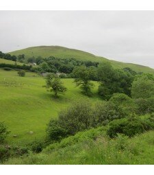
    A magnificent day to walk the 14 mile epic Above Ennerdale!

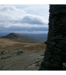
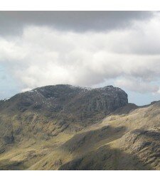
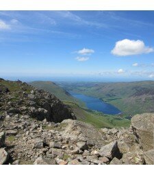
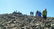
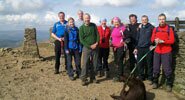
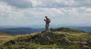
    We started from the car park on the western end of Ennerdale Water and after a few minutes of flat ground we were soon on the steep forest track that works its way up the hillside. As we gained height we edged closer to the sunshine and we could all see that it was going to be another fine day! We got to the summit of Crag Fell and the rest of the route was now visible. We descended down into the forest and climbed up the hillside to follow the long wall that goes along the hillside for just over 3km. The wall led us to the summit of Haycock where we were greeted with fantastic views of the Scafells. After a spot of lunch we desvended a few hundred metres to a col and then turned north to descend over  Tewit How. The path off the nose of Tewit How was steep so it was slower going, but before long we were back on flat ground ready to walk along the south shore of the lake. Walking back along the lake was an enjoyable way to finish the day, especially as the fading light was casting some beautiful light. We got back to the car just as it was getting really dark, ready to head home for a well earned cup of tea! A Great Day!

  • Above Ennerdale

    A great day walking on the quiet fells Above Ennerdale today.

    We started off from the Western end of Ennerdale Water, with the skies clear but the forecast stating rain was on its way. But it wasn't raining, so we were happy! We left the car park and joined the track that steeply climbs through the trees on Crag Fell's northern face.

    Not before long we were on the summit of Crag Fell, but the cloud was now coming in thick and fast, so we accepted our views were gone, for now anyway! With a strong westerly wind we opted not to head for Grike and just made our way into the forest. We emerged from the forest and started climbing towards Caw Fell. We followed the wall all the way. The rain had now arrived but fortunately it wasn't too heavy! We summited Caw Fell and then descended into the col, before making our way up towards Haycock around Silver Cove. Again we followed the wall past Little Gowder Crag and then up to the rocky summit of Haycock. We sat in the shleter and ate our sarnies and enjoyed a well deserved rest. We now started our descent and as we hit the col we turned to the north and started to descend over the long spur that is Tewit How.

    The cloud was still thick as we navigated our way down the long spur, but as we got to about 500m we emerged from underneath the cloud and were greeted by an incredible view down the full length of Ennerdale. We enjoyed this view as we descended to the shoreside. We finished off the walk by walking along the souther shore of Ennerdale Water. A great walk with some fantastic guys!

  • 24 Peak Challenge

    We had a group tackling the challenge over 2 days.Starting in Buttermere and finishing in Langdale on day 1. And starting on The Kirkstone Pass and finishing the challenge at St Johns in the Vale on day 2.
  • Yewbarrow to Caw Fell

    A great day above the Wasdale Valley taking in Yewbarrow, Red Pike, Steeple and Caw Fell amongst others, a great long day on some wonderful mountains.
  • Above Ennerdale

    A great day above the Ennerdale Valley today taking in all the fells from Crag Fell to Steeple before descending into the valley and returning by the Ennerdale Lakeshore path.

Community Feedback