Call The Lake District Walker on

Search Site

Monthly Archives: December 2011

  • Loughrigg from Ambleside

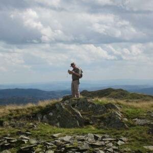
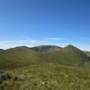
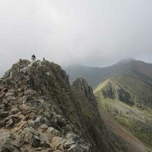
    A great day to be up Loughrigg today!

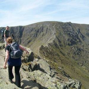
    We started the walk from the shop today and made our way across town and into Rothay Park.  As we exited the park we joined the steep road past Brown Head Farm, and continued on this track as it made its well onto the fellside. Loughrigg is a lovely little fell with many lumps and bumps, tarns and rocky outcrops. It also has more paths per square mile than any other fell in Lakeland, so it's a bit of a maze! But as you can imagine for such a small fell sitting between Ambleside, Clappersgate, Rydal and Grasmere the main paths are quite obvious!

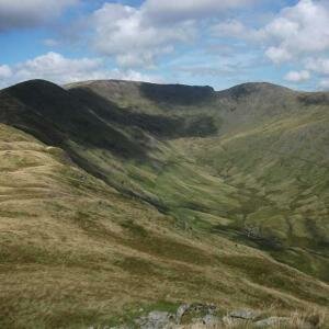
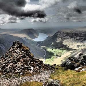
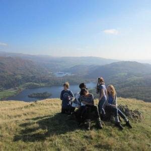
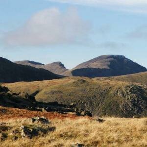
    On the way up we stopped at many great viewpoints and soaked up great views over Windermere and down into the Langdale Valley. Unfortunately as it was drizzling, and there was a lot of cloud around the views of the bigger fells were restricted. We reached the summit and after a few snaps we descended to the North-eastern side of the mountain towards Rydal Water and went and had a look around one of the massive man made caves!

    We followed the footpath that makes it way near the shore of Rydal Water and then joined the Under Loughrigg Track. The group were staying at Stepping Stones so they left here for much needed warmth! A great day out, although small Loughrigg is still a lovely mountain to climb! (Sorry about the lack of photos, my camera has broken! :(  )

  • GPS Training Course

    On a very windy morning I met Russel outside our usual spot in Elterwater, the Britannia Inn. After a brief discussion about GPS units and how to programme routes. To start off with we planned a route to the summit of Lingmoor Fell. We made our way up to the summit, and just below the summit and on the summit we really were feeling the full force of quite a powerful wind. We descended from the summit to the shores of Lingmoor Tarn, and then made our way to the base of Side Pike. We then descended to the road from Side Pike and followed the road back around the base of Lingmoor Fell and back into Elterwater.

  • GPS Training Course

    A new location for our GPS training course this morning, Loweswater. I met Chris (from yesterdays navigation course) alongside Loweswater at Waterend and we started the day by discussing GPS units. We ran through the pro's and cons of various units, focussing on our company unit, the Satmap Active 10 Plus. We plotted a nice route for the day, and as the sky was clear we were keen to get up and get some views! We started by climbing up the lane and onto the steep fell side that leads to the summit of Darling fell. All the way along we were discussing what the GPS was doing, and following the waypoints. The views from this summit were spectacular, but we knew the ones from Low Fell would be even better! We descended into the valley and climbed back up to the cairn on Low Fell, where we were indeed met by some amazing views straight down over Crummock and Buttermere. We also had fab views of the front of Grasmoor. These views needed more time to digest so we selected this as our lunch spot. After our lunch we turned North and took in the rolling tops of Sour Foot Fell and Smithy Fell before climbing to the rolling top of FellBarrow. Here we had some great views over the far north western lake District, at out over the Solway to Scotland. We descended west to meet a track which led us back to our cars at Waterend. Another fine day on the fells!

  • Navigation Training Course

    Another great day on a navigation training course today! I met Chris in Elterwater and as usual started off by discussing his current navigational abilities. Chris had done map work previously and is a very keen walker, so wanted to be taught some of the grittier techniques such as pacings and bearings. We got on our way up towards Dub How, doing navigational legs on the way covering some of the basics such as handrails and catchment features. We spent the morning making our way up to the higher ground where it is better for bearing practice, and after walking up by Megs Gill we had a quick spot of lunch. Now up over the snow line, in the mist, plus the rain (which hadn't stopped all day!)  we had some perfect conditions for some tough nav practice. We spent the next couple of hours running nav legs which got progressively harder, starting with tarns then moving onto smaller contour features. Chris navigated exceptionally well and had obviously grasped the techniques. We took a nice stroll off the hill, just as some of the mist cleared to give some nice views down to Elterwater.

  • Silver How Navigation Training

    A truley beatiful day out on the fells today!

    I met the Brendan, Ian and 12 year old Will at the Britania Inn, and all being self-procalaimed novice navigators we started from scratch. To start we covered Grid references, Map features, symbols and finally map orientation. The fells were beckoning so we got on our way. On our way up towards Dub How we covered pacing, handrails and a small amount of contour interpretation. Feeling a bit hungry we found a great lunch spot in the sun and enjoyed our sarnies with fabulous views of the Coniston Fells standing proud under a white blanket.

    We spent most of the afternoon working our way towards the summit of Silver How consolidating all the skills we had already covered, and then bearings. The summit plateau was very snowy and great fun to be walking on! We took a nice gentle stroll off the hill and enjoyed the views. A great day out, and Ian and Will will be out navigating with us again tomorrow!

  • Scafell Pike from Seatwaite

    A very snowy day today climbing Scafell Pike from Seatwaite.

    We set off from Seathwaite at 9am and climbed above Stockley Bridge to Sty Head, there was a good covering of snow on the lower slopes, a little damp, but no new snow, from Sty Head onwards there was plenty of fresh snow, soft an deep, very hard work.

    We pressed on climbing along the Corridor Route, slow progress but good fun breaking new ground, a few places on the path took a little extra care. We eventually reached Lingmell Col several people had been up this way today so we followed their footprints to the summit of Scafell Pike

    .

    It was pretty late in the day and there were no views from the summit today so we just stopped for a short lunch stop before pressing on, descending the steep slope towards Broadcrag Col, there was plenty of snow along the ridge, but walking was easy, it took less time to get to Calf Cove than during the summer!

    We descended through Calf Cove to Esk Hause, picking up the drove road down to Seathwaite, getting down to the farm at 4pm. A great day, although hard work and we hardly saw anybody all day!

  • The Greenburn Round

    Another wild day today, this time above Grasmere following the ridge from Steel Fell to Helm Crag.

    We set off from Grasmere at 8.30am and followed the lane to Helmside, climbing the southern ridge of Steel Fell. We reached the snow fairly quickly, thin and wet at first but as we climbed higher it became thicker and firmer. As we aproached the summit we were anything from ankle deep to knee deep in snow with some drifts even deeper.

    There was quite a strong wind on the top, although not nearly as strong as yesterday, we didn't stop for too long though and were soon on the western ridge, passing Griffin Tarn and climbing towards Calf Crag, the snow was now getting very deep in places especially near the summit of Calf Crag.

    After a short stop out of the wind for a hot drink we pressed on following the ridge east towards Gibson Knott, as we lost height the temperature rose and the snow was now thinning and soggy. From Gibson Knott it took no time to reach Helm Crag and descend the path down to Easdale and Grasmere.

  • Silver How Navigation Training

    A fantastic day on a navigation course, on a very wintry Silver How!

    I met ray, an aspirant ML in Elterwater, and after having a quick chat we were soon on our way up onto the fells. Ray was joining us on a navigation course to refresh his skills, as well as to learn some of the more technical elements such as contour interpretation. We climbed onto the undulating ground below Silver How and worked our way up onto the snow via Megs Gill. In places we were really exposed to the wind, which mixed with the falling snow made for some interesting conditions to navigate in!  Above about 350m we were walking on snow but these very wintry conditions did not phase Ray as he continued to navigate extremely well. We focused much of the day on contour interpretation, comparing the map to the ground and focusing on the intricate features. We got off the hill just before nightfall, slightly damp, but both having had a great day out on the fells.

  • Saint Sundays Crag

    A wild day today climbing Saint Sundays Crag from Patterdale.

    Our plans today had been to climb Helvellyn by Striding Edge, this idea was quickly dismissed with the mornings weather, instead we opted to climb St Sundays Crag.

    We set off from Patterdale just before 9am and climbed the steep path climbing the flanks of Birks. The snow today was much better than of late, becoming firmer, although often not firm enough to take your weight. As we climbed the slopes of St Sundays Crag the strong winds were starting to hit us, blowing plenty of snow and hail across us, lovely!

    We made a quick descent dropping down to the path from Gavel Pike and following this back down to the path over Birks, descending by Trough Head and following the ridge out to Arnison Crag, descending back to Patterdale.

    A wild day but a great day.

  • Navigation Training Course

    Another great navigation course today, held on the low level fell of High Rigg in St John's in the Vale. I met Graham and we started the course by sheltering from the snow and hail storms by discussing grid references, map symbols and contours in the car. There is only so much navigation that can be done from the car, so we exited, got our kit on and headed out onto the fell. High Rigg is a fantastic venue as it offers the diverse lumpy landscape, scattered with walls tarns and streams, much like our main venue Silver How.

    The fell was covered in about 5cm of snow which was great fun to be walking on, and also provides different challenges when navigating. We covered handrails, distances, pacing and timings and finally bearings as we made our way up to the 343m cairn. The weather was coming across in quick fronts which was producing snow storms interspersed with clear weather and blue skies. We spent the remainder of the afternoon focusing on bearings, and refining the complete navigational process. We finished the day in the warmth of the Lodge with a nice bit of warm food and drink for a debrief. A fab day out!

  • Helvellyn from Wythburn

    image

    image

    image

    image

    A wild day on Helvellyn today as the snow starts to arrive!
    We set off from Wythburn at 9.30am and climbed the steep path through the woods and up the steep Wythburn path to the summit of Helvellyn.
    Lower down the winds were very light but these got much stronger as we climbed higher and as we reached the summit the wind was whipping the snow and hail across the summit plateau.
    After a brief stop in the shelter we pressed on southwards crossing the summit of Nethermost Pike and climbing to the summit of Dollywaggon Pike before descending out of the winds over Willie Wife Moor and down by Reggle Knott to meet the path back to Wythburn.

  • Helvellyn from Wythburn

    image

    image

    A second winter day on Helvellyn today again climbing by the Wythburn path to the summit of Helvellyn.
    The wind today wasn't nearly as strong as yesterday but there was much more snow settling and falling today.
    After a short stop in the summit shelter we headed south, crossing Nethermost Pike and. Limping to the summit of Dollywaggon Pike before descending west over Willie Wife Moor and down over Reggle Knott to meet the path back to Wythburn.
    Not long and we may have some real winter walking on our hands!

  • Scafell Pike from Seathwaite

    Starting from Seathwaite Farm, just after a short shower of rain we made our way towards Stockley Bridge. From the Stockley Bridge we climbed the hillside past Taylorgill force and followed the path to Styhead Tarn. Very suprisingly we could see the summit of Scafell Pike, as well as Lingmell and Great End. I was also suprised to see that Scafell Pike didn't seem to have much snow on top compared to the amount Helvellyn has had the last couple of days.

    We joined the Corridor route and slowly traversed the hillside towards Lingmell Col. As we neared the col we kept getting blown by gusts of wind, so we knew that when we got to eh top we wouldn't be able to stay out in the open for long! We climbed the last steep slope to the summit, now walking through the small patches of snow. After a few summit pictures we gained shelter for some lunch. As expected the lunch stop was short due to getting cold so we got back on the trail towards Broad Crag Col. Broad Crag and Ill Crag seemed to be holding much more snow but the group still made great progress over the undulating ridge.

    We descended to Esk Hause and then dropped down the path next to Grains Gill back to Seathwaite Farm. A great day in the hills!

  • Navigation training

    Day 1:

    I met Catherine in Elterwater, and before we got going we discussed Catherine's current standard of navigation. After just a short chat with Caroline she clearly had enough knowledge to cover the basics such as grid references, map symbols etc so she wanted to focus on techniques such as bearings, and what to do when in thick mist. Taking all this into mind we headed straight for the fells. Along the way we covered pacing and navigational technique and before long we were up by Dub How. From here we could see Helvellyn with a blanket of snow on it, Winter is here!

    We spent most of the morning covering short navigational legs and focusing on distance, timing and pacing. Shortly after midday we had a spot of lunch and then focused on bearings. We got cauight in a hail storm and we both frantically threw on more layers. After the hail storm had passed we noticed Fairfield and its surrounding peaks were now covered snow too! We spent the next couple of hours using bearins and utilising all the techniques we had covered over the course of the morning.

    Day 2: Another clear morning in Elterwater today, with the higher fells in view holding more snow than yesterday!

    We focussed our navigation over towards Lingmoor Fell and after a couple of 'warm up' legs to refresh what was learnt yesterday, we continued some more complex legs, taking in all the techniques learnt. Catherine was navigating extremely well, so I progressively made each leg harder. We spent a lot of time on contour interpretation of which Catherine also grasped extrmely well. We also spent some time working on the 1:50,000 maps to test the same skills on a different scaled map. We finished the day just as a long shower was setting in and got back to Elterwater after another great day out! Congratulations to Catherine who also passed her NNAS silver award over the course of the two days!

  • Instructors Top Tips

    Although most of November didn't feel very wintry, the weather has now started to turn and there doesn't need to be snow on the ground before you need start putting extra thought into your planning and packing. Below is a series of top tips from our instructors to help you have a safer days out this winter.

    1.  Look at a suitable Mountain Forecast such as MWIS or Weatherline. These mountain forecasts will tell you what to expect at height such as wind direction and speed, precipitation, temperature, visibility and weather warnings. For example Sunday 27th MWIS displayed the temperature at 750m would be 1 or 2°C , with a 50mph wind and 80mph gusts creating a wind chill effect of -15°C !
    2. If you are heading out into an area where there is snow on the ground gain a good level of Avalanche Awareness. SAIS is a useful site for the Scottish mountains. Keep an eye on Mountain forecasts for about a week running up to your day(s) out.
    3. Plan your route and have a number of options ready in your head. Try not to be fixed on one set route as it may not be suitable on the day. As with the summer tell someone where you are going and what time you expect to be back.Don't be over ambitious. It is great to have a a long day out in the hills, but remember winter brings far fewer daylight hours and harder conditions to walk in. What you can walk in the summer may be out of reach in the winter. Knowing when to turn back is also an important skill to have. If you are new to winter walking start with some shorter days to show yourself what you are capable of and build it up slowly.
    4. Pack the right kit and make sure it works! Before heading out in winter pack your bag from scratch and do not assume something is in it. Here is a little list of additional kit you will need in the winter on top of your summer gear, so that bag you carry in summer may not be big enough.»Multiple pairs of gloves
      »Goggles, and a Buff/ Balaclava to cover your eyes and face when the weather turns bad.
      »Ice Axe and Crampons and know how to use them. Make sure they are well maintained, and your crampons fit your boot before heading out.
      »Extra Layers. Pack a spare warm layer or two just in-case.
      »A hot drink can be a lifesaver. A 1°C loss of core body temperature means you will be mildly hypothermic, but a hot drink can raise your core temperature by 0.5°C
      »Map and Compass and know how to use them! Winter Navigation is much harder so a set of honed skills are important. Practice on lower ground before heading up high.
      »Extra Food is vital as you will be burning more energy walking on harder terrain, as well as when your body works harder to keep the body warm. Eat little and often to avoid long stops.
    5. Torch!!! This point is currently being screamed by all Mountain Rescue Teams. Check it works before you head out and take spare batteries. Ensure every member in your group has one.
    6. Have fun and Enjoy! Although sometimes a hostile environment, the mountains in winter are a beautiful place. Don't forget your camera!


    If you want to learn more about walking in winter and the skills that go with it why not join us on one of our Winter Skills Courses starting January 2012. The courses are being held in the Lake District, Glen Coe and the Cairngorms and over the course of the 2 days we will aim to provide you with all the skills and knowledge you need to confidently tackle winter walking alone.

    Furthermore our Navigation Courses will provide you with all the skills to navigate accurately in summer and winter. Whether you need to start from scratch or just learn some more skills to help you when your in a white out, a One of Two day course will do the trick.

    And don't forget we are still running walks all through the winter months so if you want to introduce yourself to the world of Winter Walking, or simply get out with company then check our Diary. (All extra equipment required is provided).

15 Item(s)

Back to top