Call The Lake District Walker on

Search Site

Monthly Archives: February 2012

  • High Street (Extended)

    The forecast said the weather for today would be the best to the east of Helvellyn, and that was exactly where we were heading onto High Street and the surrounding fells.

    We started from the small village of Hartsop, and although there was some mist covering the tops we knew it would improve, and it was creating some quite dramatic views. We ascended on the good track up to the large Hayeswater Reservoir. We now climbed far more steeply up towards The Knott, from one side a large domed fell, and from the other side just a small pimple of a fell! We descended off The Knott and climbed the slopes up to Rampsgill Head. Just as we summited Rampsgill Head the mist cleared a little and provided us with some views of our next objective, High Raise. We descended and climbed the gentle slopes to the summit, and after a few pictures we turned and started to head back towards Kidsty Pike. We contoured around the head of Randale Beck and summited the fell. After our first little extention we were now heading for our main objective of the day, High Street. We walked around the Head of Riggindale Beck and across the top of Two Penny Crag before crossing the Straits of Riggindale. Now on our ascent up High Street and having already got 4 summits with no views we were really happy when the mist started to clear again. Firsly it cleared to provide views down in to Riggindale and to Haweswater in the distance, and then to our delight the summit of High Street emerged, and with it came some glorious sunshine. We reached the flat summit and thought it would be a great time to have some lunch. A mini inversion was happening as we found ourselves above most of the cloud, and the most impressive thing was that Helvellyn and its edges emerged out of the cloud, followed by Fairfield and St Sunday's Crag, a great lunchtime view! We descended to the south and then climbed again to the summit of Thornthwaite Crag, which hosts an impressive Roman Beacon. Doing well for time we thought we would extend the route once more and not descend over Gray Crag. We descended off the fell to Threshwaite Mouth and then climbed the rocky path to the summit of Stony Cove Pike. With another wall for assistance we followed it to the North towards Hartsop Dodd. On the way the cloud was breaking again to provide some more nice views. We summited our eigth and final fell and now just had a steep descent back down into Hartsop. On the way down we were treated with some lovely views of Brotehrs Water and Ullswater to the north.  Just before we reached the valley bottom we saw some old mine shafts which we went to see. We got back to the car having had a fantastic day out on a lovely group of fells.

  • Blencathra from Threlkeld

    A great but misty day climbing Blencathra from Threlkeld today!

    This fantastic route is not the longest, nor is it the highest but it is truely fantastic, especially for the keen scrambler. We met in Threlkeld and made our way through town and onto the public footpath that makes its way through the trees and to the base of Halls Fell Ridge. The start of the ridge climbs steeply, and after all stripping off a layer due to the mild conditions we slowly made our way up the fellside. After having gained lots of height in quite a quick time the ridge flattens out and this is where it starts to narrow, and the rocky buttresses emerge.

    The great thing about Halls Fell Ridge is that you can choose harder scrambling lines, or follow the nice path that winds its way up the ridge. The group all scrambled well up the ridge with some taking some tricky lines. The rock was slightly greasy which made it a bit harder. Now well into the mist we climbed and emerged on the summit. With the rock being a bit slippy we opted not to head down to Scales Tarn and back up Sharp Edge, and instead made our way west across the top of Blencathra and down Blease Fell. As we emerged back under the cloud we stopped for a bite to eat.

    After our re-fuel we descended back into Threlkeld and into the very conveniently placed pub, Magic!

  • Scafell Pike

    A fantastic day up Scafell Pike today, clear skies and great views as we climbed the highest mountain in England from Seathwaite, Borrowdale.
  • The Fairfield Horseshoe

    A great day on the Fairfield Horseshoe today, despite the mist!

    We set off about 9am from our shop in Ambleside and made our way easily out of town and to Rydal along the track that runs through Rydal Park. We reached Rydal and set on up the steepest part of the walk, up the southern face of Nab Scar. The path weaves its way up the steep fellside, and we ascended into the mist. The forecast was also showing strong winds and rain but at this time we only had the mist to contend with. As we climbed higher and higher we took in Heron Pike, Great Rigg and then finally ascended the final slope onto the summit plateau. We bagged the summit of Fairfield by which time the wind was whipping up and the rain had set in. We made our way off to the east through the thick mist and descended to Link Hause before again climbing over the rocky summit of Hart Crag. As we descended we met the long wall that was to guide us down the eastern spur of the horseshoe. We were again on the ascent and not before too long we had summited Dove Crag and then turned south to start our long descent. We stayed the left and slightly boggier side of the wall, but it was acting as a fantastic windbreak. We bagged High Pike shortly followed by Low Pike, and then the path forked and we descended down to the lovely High Sweden Bridge. Now finally out of the mist we got to enjoy views across to Rydal Water and to Windermere. We arrived back in Ambleside a little wind swept but having had a great day out on the fells.

  • Haystacks from Gatesgarth

    For some a mountain is only a true mountain if it stands above 600m. This unwritten rule used to have Wainwright foaming at the mouth, especially when it came down to his favorite fell, Haystacks. He loved this mountain, and of all the fells in Lakeland, this was his number 1. What it lacks in stature it more than makes up for with its other fine attributes. Our walk today on Haystacks, despite the lack of ascent, and the few miles walked was most deffinetely a mountain day!

    I met Mags and Anne at Gatesgarth at the southern end of Buttermere, and at this point it wasn't raining. However, this did not last long! We followed the path along the shore of Buttermere and joined the Scarth Gap Pass (A massive well done to the teams that have worked very hard over the last year or so improving this path, it's great and thank you!) We climbed up the fellside and traversed to Scarth Gap. The rain had now set in and the wind was quite gusty, but we were determined to get to the top.

    We got to Scarth Gap and then scrambled up the western face of Haystacks, one of its many great features. We got to the rocky summit but keen not to stop for long we pressed on towards Inonimate tarn, A.W's final resting place. Despite the rain the visibility wasn't too bad and we had good views of Fleetwith Pike and down to Buttermere.

    We worked our way across the tarn topped plateau, around the buttresses past Green Crag. There are a couple of huts in this area which offer great refuge, especially on wet days like this. We opted for the Warnscale Hut. The hut is small but cosy, it had foam mats on the seats, a nice guest book and even some whiskey! (Which we thought best not to drink). After a nice long stop and some drier layers we continued our descent.

    This was when our day really started to become a bit of an adventure. A large ghyll cut across the stream and was very swollen. We wern't happy to cross it and took the tough but wise descision to re-ascend to join the path that runs down the other side of Warnscale Beck (The Fleetwith Pike Side). We ascended back up the path to where it crosses the beck, but unfortunately again the swollen beck was blocking the usual crossing point. To find a suitable crossing point we followed the river towards Dubs Bottom a large comb, where the main beck split into many smaller streams which were all individually much easier to negotiate.

    With the obstacles tackled we were now back on our descent. We followed the good path down to Warnscale Bottom and then back to Gatesgarth. A fantastic adventure today on a fine mountain!

  • Helvellyn from Wythburn

    A great day today climbing Helvellyn from Wythburn.

    We set off from Wythburn Church at 100am and climbed by Birk Side in glorious sunshine to the summit of Helvellyn. There were some great views today, stretching as far as Blackpool Tower to the south and north over the Solway to the hills of Dumfries and Galloway.

    After a short stop in the summit shelter for our lunches we headed south, crossing to the summit of Nethermost Pike, the ground was a little icy as we crossed High Crag and onto the summit of Dollywaggon Pike, descending by Willie Wife Moor and down over Reggle Knott, with it's spectacular views over Thirlmere down to Dunmail Raise and the path back to Wyhtburn Church.

    A great day out!

  • Above Ennerdale

    A great day walking on the quiet fells Above Ennerdale today.

    We started off from the Western end of Ennerdale Water, with the skies clear but the forecast stating rain was on its way. But it wasn't raining, so we were happy! We left the car park and joined the track that steeply climbs through the trees on Crag Fell's northern face.

    Not before long we were on the summit of Crag Fell, but the cloud was now coming in thick and fast, so we accepted our views were gone, for now anyway! With a strong westerly wind we opted not to head for Grike and just made our way into the forest. We emerged from the forest and started climbing towards Caw Fell. We followed the wall all the way. The rain had now arrived but fortunately it wasn't too heavy! We summited Caw Fell and then descended into the col, before making our way up towards Haycock around Silver Cove. Again we followed the wall past Little Gowder Crag and then up to the rocky summit of Haycock. We sat in the shleter and ate our sarnies and enjoyed a well deserved rest. We now started our descent and as we hit the col we turned to the north and started to descend over the long spur that is Tewit How.

    The cloud was still thick as we navigated our way down the long spur, but as we got to about 500m we emerged from underneath the cloud and were greeted by an incredible view down the full length of Ennerdale. We enjoyed this view as we descended to the shoreside. We finished off the walk by walking along the souther shore of Ennerdale Water. A great walk with some fantastic guys!

  • Scafell Pike

    A great day climbing Scafell Pike from Seathwaite today.

    We set off from Seathwaite at 9am and climbed to Sty Head, the skies began grey but as we climbed up the Corridor Route to Lingmell Col.

    There was much less snow today than there had been the past few days, as we passed the 2000ft mark there was a little more, but it was very soft and wet until we were on the last climb up to Scafell Pike.

    There were some great views from the summit, but also a strong wind so after a quick photo stop at the summit we retired to a shelter for our lunches.

    After a short stop we continued, descending the steep slope to Boradcrag Col before climbing again over Broad Crag and Ill Crag descending out of the wind into Calf Cove.

    There were great views as we descended over Esk Hause and down below Great End onto the Grains Gill path, gatting back to Seathwaite just before 4pm.

    A great day on the fells.

  • Winter Skills Day

    A one day Winter Skills Course today.

    We set off from Seathwaite climbing by Grains Gill and before too long we were in the cloud, we made good time climbing to Calf Cove where we spent much of the day practising our Winter Skills on the good slope.

    As we were eating our lunches the cloud began to clear, eventually giving us good views for the afternoon.

  • Lake District Winter Skills Day 2

    Another great day above Seathwaite today.

    We set off again at 9am, this time climbing to Sty Head and following The Band up the north western ridge of Great End, the snow was a little damper today than it had been at similar heights yesterday, but we pressed on and as we got higher it became firmer underfoot.

    We decided to climb Custs Gully which was in pretty good condition and this proved easy enough as we emerged onto the summit of Great End in sunshine.

    We stopped behind the summit rocks to eat our sandwiches before descending back down to Calf Cove, spending a little time here to brush up on some of the skills that had been learnt over the weekend before descending by Esk Hasue and the Grains Gill path back to Seathwaite.

    A great day on Great End!

  • Lake District Winter Skills Day 1

    Day one of a two day Winter Skills Course today.

    We headed up from Seathwaite at 9am and climbed by Grains Gill towards Esk Hause, as we climbed to about 500m the path was getting icy so we put our crampons on and climbed below Great End, we were now in thick mist, but there was next to no wind today.

    We made good progress climbing to find a good gentle snow slope just below Esk Hause here we began to practice our ice axe arrests and several step cutting techniques. After we had exhausted this slope we headed on up into Calf Cove, the snow here was a little icier and steeper letting us practice further the skills we had just learnt on the easier slopes.

    After a quick lunch break in the shelter we continued to practice new skills on the slopes of Calf Cove, including building shelters and some basic ropework.

    At 3pm we began to head down, this time descending by the Drove Road, with some deep snow on the upper sections returning to Seathwaite just before 5.

  • Silver How Navigation Training

    A grey day today as we headed up onto Silver How for a Navigation Training day.

    A little rain had fallen this morning onto frozen ground making it a little slippery underfoot and once we were up onto the ridge we spent most of the day wearing crampons!

    We climbed above High Close before running several exercises over the summits of Silver How and Swinescar Pike before heading back along the ridge to Down Bank and descending back down to Elterwater.

    Mark did really well in some tough conditions today, at times it was near white out!

  • Ropework Day

    A glorious day above Elterwater today with a ropework course.

    I met Mark at Elterwater and we headed up onto the lower slopes of Silver How, this side of the valley was in the sunshine so was much more warm, although it often didn't feel it.

    We managed to get a lot of practice in on the small crags and hopefully MArk will feel much more confident in his ropework on his upcoming ML Assessment.

  • GPS Training

    A good day today on a GPS Training course.

    After a short 'classroom' based session in the morning we headed out, climbing onto Loughrigg and navigating around the Lily Tarn area before heading back down to Ambleside and the shop.

    This was followed by another classroom session looking at our data we had recorded and how this can be used.

    An enjoyable day and some wonderful weather while we were out!

  • Kilimanjaro Climb – Rongai Route


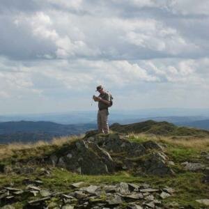
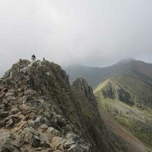
    To stand on top of a continent, one of the Seven Summits is a stunning and unforgettable experience. Kilimanjaro is the largest free standing mountain in the world, standing three miles above the surrounding plains.

    The Rongai route traverses the mountain from north to southeast, passing through rainforest on the lower slopes and close to glacial ice on Kibo’s summit cone.

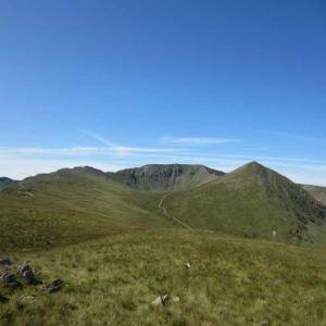
    Kilimanjaro is in fact a volcano, one of the highest in the world.

    On 18th September 2011 as a group of 12 (myself, Michael, Tony, Dave, Matt, Sarah, Lara, Ashleigh, Jean, Bill, Arven and Martin) and 40 support staff which comprised of porters, 6 guides (Naimen, Anaelia, Joseph, Robson, Ruben, Nemis) and of course the cook (Johnson), we began our climb on the Rongai route from Nale Moru at 1950m. The first day was only a half day walk on a small path that winds through farmland and pine plantations. It was a consistent but gentle climb through attractive forest that shelters a variety of wildlife. The porters carrying over 20kg balanced on their heads came running past shouting Pole, Pole which means slowly, slowly. We reached our first overnight stop “Simba camp” late afternoon on the edge of the moorland at 2600m, having covered a distance of 7km. We sorted out our tents and then did an acclimatization walk for a further 1km. The food that was prepared by the cook was delicious; it was hard to believe the quality of the food could be so good at such high altitude.

    The evening ritual was “washy washy time” about 5.30 pm which consisted of a bowl of hot water for our evening wash. Our main meal was served at 6.30pm each day and we where generally in bed before 8pm.

    The morning ritual was that the guides woke us up at 6am to see how we felt and how we had slept. This was followed by bringing us a cup of tea, coffee or hot chocolate. Although I had taken my luxury item “my pillow” I found it very hard to get a full nights sleep. At 10 past 6 we had “washy washy time” again this consisted of a bowl of hot water for our morning wash. Our breakfast was served at 6.30am.

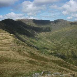
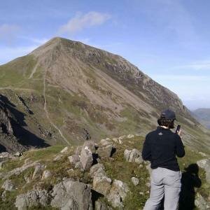
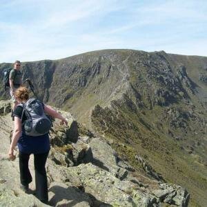
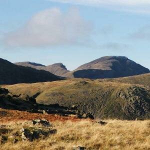
    The following morning we had a steady accent up to the Kikelewa Caves at 3450m with superb views of the Eastern ice fields on the rim of Kibo, the youngest and highest of the three volcanoes that form the entire mountain. After lunch we left the main trail and started out across the moorland on a smaller path towards the jagged peaks of Mawenzi the second of Kilimanjaro volcanoes. We reached our campsite late afternoon in a sheltered valley near Kikilewa Caves at 3600m having covered a distance of 12km.

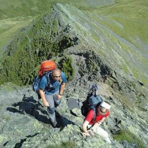
    The following day we had a steep climb up grassy slopes rewarded by superb panoramas of the Kenyan plains to the north. We left the vegetation behind us close to Mawenzi Tarn at 4330m having covered 4km. This was a difficult day as the effects of altitude began to hit with a severe headache which seems impossible to shake off. Other symptoms of altitude sickness started to set in with loss of appetite. We arrived at camp and rested for an hour before covering a further 2km in the rain to aid acclimatization.

    The following day we crossed the Lunar Desert on the “Saddle” between Mawenzi and Kibo to reach Kibo campsite at 4700m having covered a distance of 9km. This was an exhausting day and I was absolutely knackered and collapsed in the tent on arrival. The remainder of the day was spent resting in preparation for the final ascent before a very early night.

    At this point my appetite was non existent and on the morning of the final ascent I could only managed to force down a Kelloggs Rice Krispies Square Bar and a cup of tea.

    We layered up in anticipation of the cold; I had 5 layers on top plus my downs jacket, 3 layers on the bottom and two pairs of thick socks. I also wore a thermal hat, buff and balaclava. To be honest I did not really feel the cold which really surprised me.

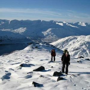
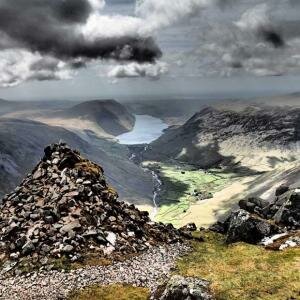
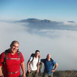
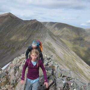
    We started the final and by far the steepest and most demanding part of the climb by torchlight at midnight. We plodded very slowly in darkness and cold at minus 17 degrees on a switchback trail through loose volcanic “scree” to reach the Crater rim at Gillman’s Point at 5686m. At this point I had been sick three times and Michael was suffering with cold feet but we dug in and carried on. I felt very tired and weak but found some inner strength as there was no way I was not going to reach that summit. At Gillman’s Point we rested for a short while to enjoy the spectacular views over Mawenzi and have a well earned cup of tea (with no milk). At this point two of our group (Bill and Jean) decide they were too weak to continue and started their descent back to camp. In addition we had already lost another member (Ashleigh) due to Altitude Sickness just after the start of the climb. Tony, Dave, Matt, Sarah,Lara, Arven and Martin had already left Gillmans point for the summit. Michael and I continued along the snow covered rim to the true summit of Uhuru Peak at 5895m with our guide Nemis, passing close to the spectacular glaciers and ice cliffs that still occupy most of the summit area.

    I was sick a further two times and my lips had started to turn blue but after what seemed a lifetime we reached Uhuru Peak at around 9.30am We stopped for a short while to admire the fantastic views and take photos before starting our descent to Kibo Hut at 4,700m. Just after leaving the summit I was sick again so we had to descend fairly quickly. We reached Kibo Hut at around 12.15pm after walking for 12 and a quarter hours. We collapsed in our tent and a couple of hours sleep, later we were woken to continue our descent to our final campsite at Horombo at 3720m. This was an extremely long and hard day covering 22.5 k with over 17 hours of walking.

    On the morning of the last day we woke at 6am for the “Tipping Ceremony” and the traditional dancing and singing. All the support staff and of course us climbers sang the local song:

    Jambo. Jambo Bwana.
    Habari Gani. Mzuri. Sana
    Wa Geni. Mwakaribishwa
    Kilimanjaro. Hakuna
    Matata

    It was amazing to see how appreciative the locals were to receive items that us Brits were not taking back to the UK, this included items like, gaiters, waterproofs, drinking canisters, gloves, shovel, sweets, even bin liners. Each member of our group donated $125.00 towards the tip which was divided amongst the 40 support staff. On top of this we gave individual tips to the guys who set up our tents each day and those guys who helped us down the mountain.

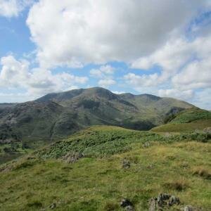
    The following day we continued our descent to Marangu Gate, a sustain descent with wide views across the moorlands which took us into the lovely forest around Mandara at 2700m. We went off trail down 110 steps to visit a waterfall to take photos, the downside was we had to climb back up the 110 steps. The trail continued through semi-tropical vegetation to the National Park gate at Marangu by mid-afternoon for a well earned rest and a much needed shower and alcohol (but unfortunately they had no Southern Comfort!! So had to make do with Tia Maria and Malibu!!).

    Climbing Killimanjaro is the hardest thing I have ever done it was so exhausting yet so rewarding. Nine out of our group of 12 reached the summit. Everest Base Camp here I come….

    Many thanks to Janet for the above account of their ascent.

15 Item(s)

Back to top