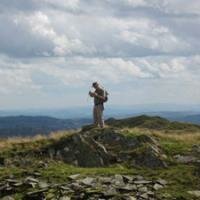
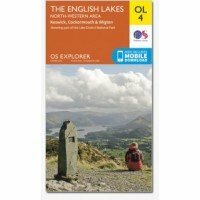
Map sheet number OL4 in the OS Explorer map series, The English Lakes: North-western area, is the ideal map for exploring the north-west area of the Lake District. This area is home to many natural and man made attractions from oval hills shaped by glaciers to stunning views over majestic lakes. The OS Explorer map for The Lake District: North-western area is available in both the standard paper version and weatherproof 'Active' version.
Just to say thank you so much for an insightful two days. It was an amazing course! On Monday, I wore a groove in Nanny Lane on the way up and down to Wansfell Pike while practising my pacing. On Tuesday, I went to Grasmere and up to Lang Howe, Silver How, Dow Bank and back to Grasmere. And I was almost overcome with emotion that every blobble I walked to, fitted the map. And I didn't get lost once, thanks to your teachings. No precipices, no crags, it was all very easy underfoot. I have to admit, I was averaging only about 1km an hour, double and triple-checking etc., but with more practice, I will learn to trust myself more and get quicker. And anyway, the view is there to be admired.
Many Thanks the walk today it was fab , although very hot :) The guide was great & please pass on our appreciation To him.. Many thanks & Hopefully see you again soon Bev
John, Jenna and I would like to pass on our thanks for the excellent hike we had with James yesterday. He made a tough walk very enjoyable and passed on a wealth of information regarding peaks etc. Thanks again and we will certainly recommend and use your services again. Andy
Just a very quick note to express our appreciation for the great day out we had with Aled. He was thoroughly professional, very friendly and got us to Scafell Pike and back down again with a broad smile on our faces. We will definitely be back for more !!
Hi Just wanted to say how much we enjoyed and how useful we found the Beginners Navigation Course with Geoff which we went on last Tuesday 26th March. Having pre booked the day, we had to go despite the weather conditions. However once there we both felt it was probably the best conditions in which to test our navigation skills and my husband called it a “baptism of fire”. It was a bit daunting to see all that snow and not a path in sight. There were 4 of us in the group. I am ok with a map and my husband has done compass work before but as I outlined to Geoff I am losing my confidence in navigating and get a bit panicky that we might get lost even though we have been walking in the Lake District for the last 30 years. Geoff was very patient with us all as a group, offering expert tuition in a friendly but professional manner which we have since put into practice during the rest of our holiday in the Lakes. As a result of this day we will however be buying a new map as our map is quite old, the scale being 1 inch to 1 mile !!!. Thank you. Susan and John
Hello John. I would like to thank you for making our trip to the Lake District We obviously were a bit ambitious regarding our ability to hike the round in five days but we had a ball. Rick and John were superb guides and we enjoyed their company. The weather could not have been better so the views were superb. It was an experience we shall always cherish. Great memories!
The only way to go..! Early in the year I decided that Scafell Pike needed to be climbed and so booked with Lake District Walker thinking that perhaps a guided climb would be the sensible way to go. Arrived at the meeting point with my son and daughter on what was a truly wet and miserable Saturday morning. Because of the terrible weather other groups were calling off but our guide Geoff and the others in our group were up for it. The weather was so lousy and visibility so poor at times that, had we not had a guide, I think I'd still be on that mountain. Being part of a mixed group was great, making for a memorable shared experience. The climb itself was not at all easy and I was glad that we'd put some training in before hand, although Scafell's rather martian terrain and the weather on the day, we just could not have prepared for. All in all very challenging but equally very rewarding. Highly recommend using The Lake District Walker as I would not have wanted to do this, particularly with conditions as they were, alone. Highly recommended.
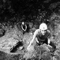
Hi John Just got back from rock climbing Amazing really enjoyed it I wasn't very good but loved it, Mal an Josh managed to get to the top James was excellent with us all. Thank you for booking it for us and for a great day ghyll scrambling with yourself on Monday Kind regards Yvonne
Hello, on May 25th Carolyn and I took on the Yorkshire Three Peaks Challenge along with other walkers. I just wanted to say a big thank you as we would never have done it without you. Firstly, actually booking the date with you made us feel committed and then having a guide gave us confidence and moral support. James was the guide you supplied for this day and may I say, he is an asset to your firm. He's calm, friendly, encouraging, professional and got a good sense of humor ( I hope his mum is proud). He not only looked after his group of walkers but was supportive to others. Had we not have signed ourselves up to take the challenge on with you I think we would have gone home after the first 10 minutes. Instead we completed in challenging weather within the allocated time. Thank you again
Hi John FYI Peter was a very good guide, he took us up a great (scenic) route to the top, we got very lucky with the weather and had some excellent views. Many thanks again for arranging, we had a (unexpected) great day on Scafell Pike Kind regards Rob
Hi, We just did a walk today with John and wanted to feedback what a great day out it was. We were booked on the Steel Fell and Helm Crag walk, but were a little concerned about our capacity, but as we were the only three on the walk John took us on an alternative walk which we just loved! After today none of us would hesitate to book walks through you guys again. Once again - a day which started off with us feeling uncertain and faced with uncertain weather, turned out to be our favourite day walking so far. Giovanna
The best way to see the high points of the lake district. Like a previous reviewer I wanted to see the best and highest points of the lake district, but felt uncomfortable going out on my own as the conditions can change quickly. I signed up for two different tours, Scafell Pike and Great Gable. The guides were incredibly knowledgeable and I felt both entertained and well looked after. On the first trip we were a group of 5 with various levels of skills and on the second trip which took place in quite harsh weather it was only me. I would strongly recommend using the company and will myself do so again. It is a great day out and the price is more than reasonable.
A big thank you to James for guiding us up to the summit of Scafell Pike. He was very tolerant of my slow progress and made the walk interesting for my 9 year old son by adding in some extra scrambly bits for him.
We joined a group walking up Scafell Pike on Saturday 11th August and loved it! Scafell is not easy at all, quite strenuous for a large part and some of the terrain is very difficult, but it's worth it! The view from the top is amazing if you're lucky enough to get a clear day. This trip was easy to book, and the information given was clear. We were provided details of the meet point as well as directions and a list of equipment we needed. Our guide, Hugh, was extremely friendly, professional and knowledgeable and put us at our ease. I felt a little intimidated at first as some of our group were clearly experienced walkers and my husband and I were not nearly as fit as they were, but Hugh (and everybody in the group) were encouraging and friendly and made the day a great success. Thanks Hugh. Just do it, book a tour and go climb Scafell. It's worth the effort!
Helvellyn my 60th birthday treat! As I have always wanted to climb Helvellyn on the Striding edge route my wife organised a guided walk through Lake District Walker for my 60th birthday. I was very impressed with the guide John who was friendly,professional and gave our group the confidence to tackle this awesome peak. We were lucky to complete most of our climb in glorious autumn sunshine and John's extensive knowledge of the various routes enabled us to reach the summit before the low cloud came in to spoil the views! We also did Catstycam on the way down, a fabulous day which all three of us in the group thoroughly enjoyed. Thanks John .
First time up Scafell Pike as a family of 4 (two adults and two boys aged 10 and 7). Was a little apprehensive about taking them up the highest peak in England so I decided to book a guide from The Lake District Walker company. Every single part of the experience was exceptional. We had lots of rests on the way up and our guide took the time to explain points of interest, certain rock types, fell history etc. It was way above and beyond the call of duty. He was unobtrusive but always on hand to answer questions posed by ourselves and the kids. Well worth every penny for safety alone. Thanks very much. We won't forget the experience!!
returned to the lakes again this october;took 3 guided walks with John and his team of guides.As it was last year AMAZING************** Really enjoyed the walks as ARNIE said I,ll be back ( next year) Martin & Maureen
Always fantastic guides I've been on three walks with The Lake District Walker this year. I'm not an experienced walker so started with a lower fell walk in the spring (Steel Fell and Helm Crag), did Helvellyn and Striding Edge in the summer, and Scafell Pike this weekend in the rain and cold! So I've done some more challenging walks and been out in good weather and bad. Geoff and the other guides I've had are all excellent. They are friendly, knowledgeable, always keeping the group motivated and taking care of us all (and, in the case of Scafell in bad weather - getting us all off the mountain in one piece!). There are so many walks to choose from, so you can start with an easier walk and build up to something really challenging. The guides are fantastic for both types of walk. And I can't believe how low the prices are, it's more than worth it. Highly recommend.
Hi John, many,many thanks for all your guidance,help,transportation and kindness during the last 3 years while completing my Wainwrights.Everytime it was,in good or bad weather,an experience of a lifetime.I couldn't have done it without your expertise and love for The Lake District.A great compliment to all your other guides as well, Harry
My son loves walking and wanted to do Scafell Pike. A little nervous we Phoned The Lake District Walker. They were so helpful in arranging our trip. So we met John and I intrusted him with my family . They had fun and John was so kind to my daughter Becky. Thank you for helping then fufill a dream . John you rock
Hi John Would like to say thank you to you and Ross for my 2 day course I feel the knowledge you both got across was excellent and look forward to using the skills in the near future and will definitely look at future courses with yourself and your team.
Hi John, I really just had to write and let you know how much I thoroughly enjoyed the Snowdon Horseshoe walk last Saturday. The last time I attempted Crib Goch two years ago the weather was dreadful and we backed off, but last Saturday conditions were perfect. I particularly wanted you to pass on my thanks to Owen for leading this walk so well. Apart from him pointing the way I didn't find any of the scrambling difficult and enjoyed every minute. He is a thoroughly nice chap, knowledgeable and easy to talk to and get along with. I would really hope that I can walk / scramble with him again sometime (and your good self of course). Best wishes, Frank.
Hello all, l would like to thank James who was our guide on 2 walks, Helvellyn on the 24th and Langdale Pikes on the 25th. He is obviously very experienced at what he does.
Hi John, Just a final thank you to your company and the guidance of James today up Bow Fell & Scafell Pike! Had a wonderful day and the weather was accommodating as well! James was a knowledgeable and gracious guide. Please thank him once again for a great job well done. Gary
Highly recommended! Due to drive up to the Lakes on Thursday evening, I made a decision on Thursday morning to climb Scafell Pike on Saturday! I came across The Lake District Walker in a Google search and just went for it. I've never climbed a mountain before, and am reasonably fit, but was slightly nervous, naturally. I was greeted warmly by our guides, Alec and Claire, and the rest of our group as we set off. To cut 9 long hours short - it was only due to the friendly and supportive nature of the group, and our guides in particular, did I make it up and down Scafell Pike that day. At times, I cried out of pain and mental tiredness - but each time, Alec and Claire supported me and talked me through it. And they were very candid about what to expect, which is what I needed - the worse thing a climber needs is to be told they'll see the peak around the next corner and then not see it! They are both thoroughly knowledgeable about not only the routes but also on how a novice should approach the climb, so you feel safe.
The Crinkles, Thursday 6 June with Alex. A superb day out. Alex is to be highly commended on his knowledge, his caring attitude and his confidence-inspiring ability in all aspects of guiding. He made sure that we got the most out of our day whilst ensuring that no one individual was beyond their ability. As well as The Crinkles themselves, we took in Cold Pike and then had enough time (and energy!) to summit the mighty Bow Fell. Awesome views, when the mist allowed! Will certainly use The Lake District Walker (and hopefully Alex) again for both Fairfield Horseshoe and Striding Edge/Helvellyn. Many thanks, Steve (walked with Michelle & Kath)
A big thanks to John, Hugh, James and Jeff for helping our group of 30 complete the Yorkshire 3 Peaks on Saturday. Everyone had a great day and really enjoyed it and I know that the last group who completed the the challenge were extremely grateful to you guys, especially Hugh, for helping them get through it, even though there was only limited time left in the day to complete it. All the members from TMfit Personal Training Studio send their thanks and best regards to you all!
Hi there, Just wanted to say thank you to Fay for a great day out on a very busy Scafell on Saturday. We had a really good day and thought Fay was very professional and pleasant; she also coped really well with our very mixed ability group and kept everyone safe and happy. Many thanks, Frankie and Steve - Scafell Pike Saturday 19th April
Hi John Just thought I would give you some feedback on Sunday's climb up Tryfan and Bristly Ridge. I really enjoyed the day, the weather was brilliant on the climbs (so glad of that) with poor visibility on the top and a tiny bit of rain on the way down, this mixture of weather seemed to add to the day's fun. The two ladies in the group were great (a lot of girl power on Tryfan on Sunday, I was being overtaken by a young 13yr ? old and her dad) and Owen was an excellent guide, not sure if I will do that climb again (scary!) but if I did then it would be with someone like Owen nearby (and hopefully no 13yr old girl making me look like a nervous 43yr old bloke!) All the best Huw
If Ross hadn't told us it was his first walk with LD Walker as a guide we never would have known. He did a superb job of catering for all levels within the group. My friend is less experienced than I am in terms of mountain walking and was quite nervous going over Striding Edge but he made sure that she did so safely. I've done a fair bit of walking with groups, and he's one of the best guides I've come across so far. We both had a great day and will certainly book onto another walk next time we are up in the Lakes.
After promising myself for goodness knows how long that I'd climb Scafell Pike and finding myself with something of a free weekend I decided I would get on with it. I thought about heading up there solo, I had tackled other fells that way; but this wasn't somewhere I particularly wanted to be on my own with the possibility of the weather turning nasty. A google search brought up 'The Lake District Walker' and a simple to follow on-line booking system and paypal payment had me signed up, within minutes. I thought the cost of joining the walk was reasonable and helpful kit, lists, joining instructions and route information provided electronically. I arrived at the meeting point. Found a couple of other walkers and Bryan, who was leading the walk was on time and gave everyone a warm welcome. The group was made up of 7 ladies of various ages and abilities plus Charlie the dog. Bryan was incredibly patient and knowledgeable about the mountain and the area. He made a point of chatting to everyone and was always willing to assist if one of us was finding a section tricky. It's fair to say that we weren't the speediest group on the mountain that day, however there was never any frustration from Bryan or pressure to speed up. We had the added bonus that the cloud that had been covering the summit all day lifted when we arrived on the top. Really enjoyed the whole experience and will definitely book again.
Fantastic guided walks I have been out with The Lake District Walker a few times now and they are an excellent company. The guides are all really friendly and very experienced and make the day really enjoyable even in the most trying of weather conditions! They have a fantastic range of walks and will go out even if only one person has booked on. This year my friend and I have scaled Helm Crag, Striding Edge and Scafell Pike and we will be back for many more. We are already avidly looking at the 2014 events! Thank you for making fell walking so accessible, challenging and fun.
2nd Trip was excellent too! This was our second use of Lake District Walkers services. This time a whole day's rock climbing 1 to 1 for my wife's birthday. Teaching was excellent as always and she really enjoyed herself. Keep up the good work guys.
Pillar from Wasdale Head Hi John, Just a quick thank you from us for a very enjoyable walk on Saturday. We plan to come up again towards the end of the summer & I will give you a call. Kind regards Martin
Have used this company several times this year - excellent guides, very professional in every respect. Have really enjoyed every walk I've done with them - perfect! I won't hesitate in using them again in the future.
Helvellyn - a fantastic day out We've been walking in the Lakes for many years, and have conquered some of the higher peaks - Langdale Pikes, Fairfield Horseshoe, but somehow Helvellyn had always eluded us. After a 4 year break from visiting the Lakes we felt that this year would be the time that we had to do it, but weren't sure we could do it on our own. I found the Lake District Walker on the internet and was immediately impressed by the professional website, and the range of walks and events on offer. I booked the Helvellyn trip online and immediately received a confirmation email plus loads of information about the day. When the day came it was so sunny and quite warm, we couldn't believe our luck! Our guide was excellent company, we felt we were walking with an old friend. We're so glad we did the walk with him, he knew exactly the right way to tackle the more challenging parts of the walk. As a bonus, he was also happy to take photos for us with our camera so we have come back with a fantastic record of the day, where we're actually both in the photos, some of which are quite spectacular! We can't wait for our next visit to the Lakes and will be back in touch to arrange the Scafell Pike trip!
Hi John We had a Fabulous day today , thanks and huge thanks to a very attentive interesting guide.. Attached some of the photos.. It was Tonys 70th birthday today and he thoroughly enjoyed this walk.
Just wanted to say thank you for a great day yesterday doing the Yorkshire three peaks. Our guide James was excellent and helped us to finish with a smile on our faces.
I just wanted to thank your company and James for making it possible for me to climb the three peaks I had set as my goals. James was quietly confident and showed lots of patience. I wish him well ...he sounds like he knows where he wants to go! And hopefully I will come back in the near future to do lots more. Kind regards Beena
These guys are very helpfull, knowledgable and professional. We had an excellent day and the views were amazing. John (our guide) is such a pro, and I would rellish the chance to walk with him again.
Hi John, Please pass on my thanks to Ian Simpson for making the trek so enjoyable; it was a great day, and thank you for helping me out at such short notice. Best regards Harry.
Hi john We all had a great time on Saturday! Your guides were brilliant with us.. We raised over £2400 for the challenge so far! Thanks again for keeping us safe Donna
Just the sort of guiding for the sort of "tramping" we wanted to do. My college-aged daughter and I had the pleasure of being guided on a "moderate" walk (approx. 5-6 hours) by one of the Lake District Walker guides. First, the level of tramping was just what we wanted, and the guide was an excellent "companion" who set a good pace that was just right. He is very competent and it is obvious he loves what he does. Moreover, he has the people skills that one should have in such a job. We enjoyed it tremendously, and appreciate being able to spend time in this beautiful area.
Didn't get a chance to say thank you and goodbye to John and James today after a wonderful walk up Helvellyn and Striding Edge. Your guiding was excellent and I look forward to more of it in the spring. Good luck with the dissertation James. Anna
Hi John, I just wanted to thank you, and your guides, Rick and Hugh, for an amazing day on Saturday. The guides were perfect, the route was amazing and the kids thoroughly enjoyed themselves. The weather was on our side, the views were spectacular, we all had a fabulous day. The kids enjoyed the climbing sections and were up front all the way. They didn't moan once and I think they enjoyed it so much as the route was varied, so thank you. In fact they are keen (as are we!) to do another. Would you have any suggestions?
Hi John, Just wanted to drop you a note to say thanks - the day went very well. Peter and Hugh were great and helped us all around comfortably inside our 12 hour target. I know everyone on the team was very appreciative. Both were also great company. All the best, Jon
We went on a guided walk up Scafell Pike. We had a really great day, the guide was friendly and knowledgeable and allowed the group to go at the pace best for us. He also took people off to do little detours to bag other fells on the way. The walk was fantastic and the whole experience was something to remember.
Hi John Just a quick thank you from us for a very enjoyable walk on Saturday. We plan to come up again towards the end of the summer & I will give you a call. Kind regards Martin


 © 2015 The Lake District Walker Limited. All Rights Reserved.