-
Diary
-
Routes
-
Central Fells
- Helm Crag
- High Raise
- Langdale Pikes
- Loughrigg Fell
- Sergeant Man
- More in Central Fells...
-
Eastern Fells
-
Far Eastern Fells
-
Northern Fells
-
North Western Fells
-
Southern Fells
- Bowfell
- Coniston Old Man
- Crinkle Crags
- Scafell
- Scafell Pike
- More in Southern Fells...
-
Western Fells
-
Outside the Lakes
-
Walking Weekends
-
- Navigation & Skills
- Activities
- Challenge
-
Private Guiding
Popular Events-
- Add to Wishlist
- | Add to Compare
-
The Bob Graham 5 Day Challenge
 £299.00
- Add to Wishlist
- | Add to Compare
-
-
Diary
-
Routes
-
Central Fells
- Helm Crag
- High Raise
- Langdale Pikes
- Loughrigg Fell
- Sergeant Man
- More in Central Fells...
-
Eastern Fells
-
Far Eastern Fells
-
Northern Fells
-
North Western Fells
-
Southern Fells
- Bowfell
- Coniston Old Man
- Crinkle Crags
- Scafell
- Scafell Pike
- More in Southern Fells...
-
Western Fells
-
Outside the Lakes
-
Walking Weekends
-
- Navigation & Skills
- Activities
- Challenge
-
Private Guiding
Popular Events-
- Add to Wishlist
- | Add to Compare
-
The Bob Graham 5 Day Challenge
 £299.00
- Add to Wishlist
- | Add to Compare
-
- You have no events in your shopping cart.
- Home /
- Search results for: 'silver howe'
-
- The comparison list was cleared.
Search results for 'silver howe'
-
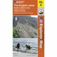
Lake District South Western Area: OL 6 (2011 Edition)
Regular Price: £7.99
Special Price £4.99
Map sheet number OL6 in the OS Explorer map series, The English Lakes: South-western area. is the ideal map for discovering all that the south west area of the Lake District has to offer. Highlights include: Scafell Pike, Coniston, Wast Water and Tarn Hows. The OS Explorer map for The Lake District: South-western area is available in both the standard paper version and weatherproof 'Active' version.
Learn More- Add to Wishlist
- | Add to Compare
-
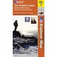
Lake District South Eastern Area: OL 7 (2011 Edition)
Regular Price: £7.99
Special Price £4.99
Map sheet number OL7 in the OS Explorer map series, The English Lakes: South-eastern area, is the ideal map to use when exploring the south-east area of the Lake District. With the impressive lakeside scenery around Windermere and the dramatic mountains that make up the region, this area is perfect for hiking holidays and days out. The OS Explorer map for The Lake District: South-eastern area is available in both the standard paper version and weatherproof 'Active' version.
Learn More- Add to Wishlist
- | Add to Compare
-
Lake District South Western Area: OL 6 Active Map (2011 Edition)
Regular Price: £14.99
Special Price £8.99
Map sheet number OL6 in the OS Explorer map series, The English Lakes: South-western area. is the ideal map for discovering all that the south west area of the Lake District has to offer. Highlights include: Scafell Pike, Coniston, Wast Water and Tarn Hows. The OS Explorer map for The Lake District: South-western area is available in both the standard paper version and weatherproof 'Active' version.
Learn More- Add to Wishlist
- | Add to Compare
-
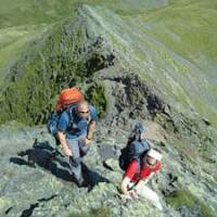
Silver How Evening Walk
£22.00Learn MoreDifficulty:
Exposure:
A short steep climb to start then easier ground, wonderful views over Grasmere, Rydal and the Langdale Valley Distance: 7.5km / 5 miles Ascent: 400m / 1300ft Duration: 3 hours Maximum Group Ratio: 12:1 - Add to Wishlist
- | Add to Compare
-
Pen, Scafell Pike & Scafell
£22.00Learn MoreDifficulty:
Exposure:
This walk offers a unique opportunity to summit both Scafell Pike and Scafell in a way most walkers have never considered climbing Distance: 16km / 10 miles Ascent: 1300m / 4300ft Duration: 7 hours Maximum Group Ratio: 10:1 - Add to Wishlist
- | Add to Compare
-
Grasmoor End to Whiteside: Private Guiding
£120.00 As low as: £20.00Learn MoreDifficulty:
Exposure:
A long but easy scramble up the dramatic face of Grasmoor End, stunning views thoughout Distance: 9km / 5 miles Ascent: 960m / 3200ft Duration: 6 hours Maximum Group Ratio: 10:1 - Add to Wishlist
- | Add to Compare
-
NNAS Silver 2 Day Navigation Course: Private Guiding
£210.00 As low as: £90.00Learn MoreDifficulty:
Exposure:
A comprehensive 2 day course looking to advance their mountain skills under the guidance of a highly qualified instructor
Distance: 10km / 6 miles per day Ascent: 500m / 1500 ft per day Duration: 2 Days hours Maximum Group Ratio: 4:1 - Add to Wishlist
- | Add to Compare
-
The Welsh 3000ft Challenge: Private Guiding
£800.00 As low as: £75.00Learn MoreDifficulty:
Exposure:
A very hard walk over rough ground with high levels of exposure at times
Distance: 39km / 24 miles Ascent: 3500m / 10800ft Duration: 24 hours Maximum Group Ratio: 8:1 - Add to Wishlist
- | Add to Compare
-
24 Peak Challenge: Private Guiding
£600.00 As low as: £70.00Learn MoreDifficulty:
Exposure:
A very long walk over rough ground, a great very hard challenge event
Distance: 50km / 32 miles Ascent: 4000m / 13000ft Duration: 2 Days Maximum Group Ratio: 10:1 - Add to Wishlist
- | Add to Compare
-
The Cross Lakeland Challenge: Private Guiding
£500.00 As low as: £70.00Learn MoreDifficulty:
Exposure:
A long walk, crossing the Lake District from East to West, from Wasdale Head to Wasdale Head
Distance: Up to 50km / 31 miles Ascent: 2300m / 7500ft Duration: 2 Days Maximum Group Ratio: 10:1 - Add to Wishlist
- | Add to Compare
Shopping Options
- Category
-
- Navigation & Skills (8)
- Challenge (12)
- Locations (41)
- Private Guiding (34)
- Keswick Mountain Festival (4)
- Maps & Guidebooks (8)
- Event Type
-
- 01: Diary Walks (17)
- 03: Evening Walks (1)
- 06: Walking Weekends (3)
- 10: Skills Courses (6)
- 11: Beginners Navigation (1)
- 13: NNAS Courses (1)
- 17: Private Guiding (42)
You have no events to compare.
- Blog
- How to Book
- Medical Forms
- Am I fit Enough?
- Equipment Required
- Contact Us
- Terms & Conditions
- Privacy Policy
- My Account
- Jobs at TLDW
- Testimonials
- Gift Vouchers
Join us on Facebook and hear about our news and see photos.
- YouTube
Phone: (Local Rate)
Email:
Our events are run on location throughout Great Britain, please check your booking information for specific event information including where to meet and directions to start points
- Site Map
- Search Terms
- Advanced Search
- Orders and Returns
- Contact Us
- Testimonials
 © 2015 The Lake District Walker Limited. All Rights Reserved.


