Call The Lake District Walker on

Search Site

Monthly Archives: February 2011

  • The Fairfield Horseshoe

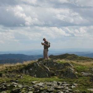
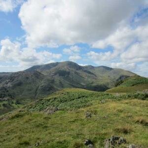
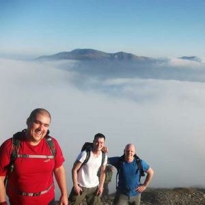
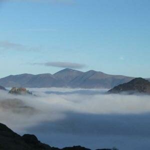
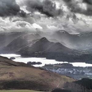
    A great day on The Fairfield Horseshoe today. After a damp start the weather quickly improved and by the time we had climbed Nab Scar the drizzle had turned to sunshine.

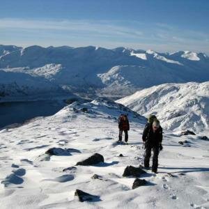
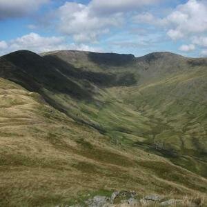
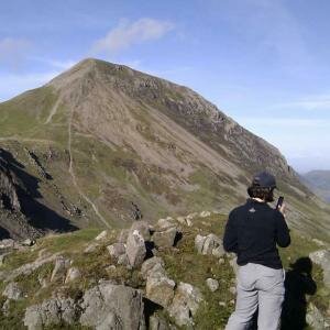
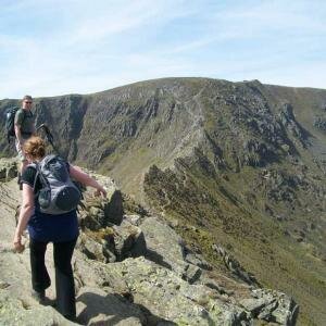
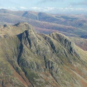
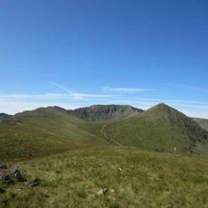
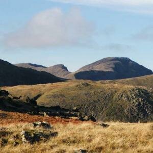
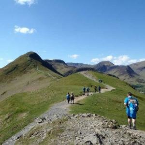
    We followed the ridge from Nab Scar along the ridge over Heron Pike and Great Rigg to the summit of Fairfield. There was a strong northerly wind on the summits today, quite cold and gusty at times and a light dusting of snow on the higher summits, there seemed to be a little more snow to the west on Bowfell and the Scafell Range.

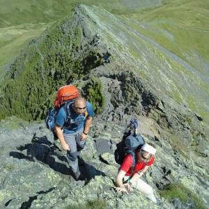
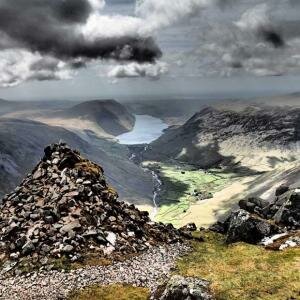
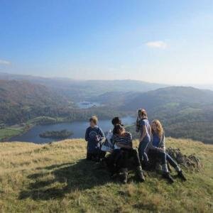
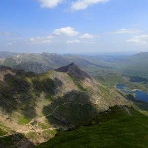
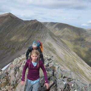
    We stopped in the Fairfield summit shelter to eat our sandwiches before following the ridge over Hart Crag and Dove Crag following the long ridge down over High Pike and Low Pike in bright sunshine and dropping down to High Sweden Bridge and following the track back to Ambleside.

  • Scafell Pike

    A great day on Scafell Pike today. We climbed via Sty Head and the Corridor Route to Lingmel Col and the summit of Scafell Pike. The weather improved quickly during the morning to give us a good dry day with plenty of views.

    From the summit of Scafell Pike we followed the ridge north crossing Broad Crag and Ill Crag before descending through Calf Cove to Esk Hause and down the Grains Gill path back to Seathwaite.

    A great day with plenty to see along the way.

  • Helvellyn

    A good day climbing Helvellyn from Wythburn today. We set off from Wythburn in light rain, not expecting too much from the weather. As we climbed above Comb Gill the drizzle stopped, but above Comb Crags we were in the cloud, we were in thick clouds all the way to the summit of Helvellyn. There were a few small patches of snow on the way up, but nothing that couldn't have been walked around if needbe.

    We ate our sandwiches in the summit shelter without much of a view before following the ridge south over Nethermost Pike and High Crag.  As we descended from High Crag we emerged from the cloud, at first getting glimpses of views in all directions before as we descended from Dollywaggon Pike emerging below the cloud. The views on the way down over Willie Wife Moor were great, the clouds broke completely to give us sunshine as we descended over Reggle Knott and followed the forest track back to Wythburn Church.

  • Silver How Navigation Training

    Navigation Training today on Silver How, the weather wasn't great with low cloud and drizzle pretty much all day but we had  good day following the ridge from above Red Bank along over Silver How to Swinescar Pike, with several navigational exercises along the way.

    We descended by Megs Gill and Thrang Crag to Chapel Stile and followed the riverside path back to Elterwater.

  • Red Screes

    good day climbing Red Screes from Ambleside today, we set of from Ambleside and climbed by 'The Struggle'  and climbing the long southern ridge of Red Screes, by Snarker Pike. We were in thick cloud from just after leaving Ambleside.

    As we approached the summit of Red Screes we reached good snow, quite thick in places and plenty of it!

    There were no views from the summit, but we stopped and ate our sandwiches in hope before descending north to Middle Dodd, over some deep drifts.

    We descended down to Scandale Pass and down into the Scandale Valley and followed the track back by High Sweeden Bridge to Ambleside, dropping below the cloud only as we reached the valley.

  • Winter Skills on Esk Hause

    A good days Winter Skills Training today. We climbed from Seathwaite in thick cloud to practice skills on the slopes below Esk Hause.

    After lunch we climbed towards Esk Hause, building shelters in a large snow drift en-route before climbing to Calf Cove where we found an excellent slope for practicing ice axe arrests and some crampon techniques before descending back to Seathwaite by the old drove road.

  • Scafell Pike

    A wonderful day climbing Scafell Pike from Seathwaite today. We didn't hold out much hope when we set off from Seathwaite with strong winds and low clouds and a poor forecast though.

    We climbed by Sty Head Pass and onto the corridor route, entering the cloud base at about 2000ft, the damp snow on the lower slopes became firmer as we reached the 2000ft mark and made good walking conditions as we climbed by Lingmell Col and up towards the summit of Scafell Pike. As we climbed towards the summit the clouds above us started to clear a little, with blue skies above, and to our left we had glimpses of Broad Crag and Great End emerging from the clouds.

    As we reached the summits the clouds parted  giving us some wonderful views across the clouds, with occasional glimpses of summits sticking through, Scafell, Great Gable and Skiddaw were visible at times, poking up through the clouds.

    As we sat and ate our sandwiches more summits started to show themselves for short times, Broad Crag, Ill Crag and Great End as well as Bowfell were visible at times.

    After the sandwiches were eaten we descended north, crossing Broadcrag Col to Broad Crag, as we climbed the slope to Ill Crag a great view west over Great Gable cleared. The boulder fields were no problem today with plenty of firm snow covering them and we descended by Calf Cove to Esk Hause and down below Great End and down the Grains Gill path back to Seathwaite.

  • The Fairfield Horseshoe

    A cloudy grey day on the Fairfield Horseshoe today, we set off from Ambleside at 9am and followed the track to Rydal Hall climbing the steep slopes to Nab Scar. It wasn't long before we were in the cloud, seeing very little from then on.

    We followed the ridge from Nab Scar over Heron Pike to Great Rigg, from here on we were walking on good snow, much crisper than on Wednesday.

    We climbed to the summit of Fairfield and sat in the summit shelter to eat our sandwiches, watching a few people appear and then quickly disappear in the mist.

    From Fairfield we continued to follow the horseshoe route, crossing to Hart Crag and then Dove Crag, as we descended towards High Pike we dropped below the snow line onto the damp grassy slopes below, and as we descended from High Pike to Low Pike we dropped below the cloud to get some murky views over Windermere and Ambleside.

    We dropped down from the ridge to High Sweeden Bridge and followed the track back to Ambleside.

  • Bowfell & The Crinkles

    A wonderful day on Bowfell and the Crinkles today, we  set off from the Old Dungeon Ghyll in Langdale at 10am and climbed along The Band, into the thick cloud pretty quickly. This continued as we climbed towards the Climbers Traverse path, the snow was getting thicker as we climbed, but at this level it was still pretty wet snow, we decided against the Climbers Traverse path and climbed directly to the summit, emerging from the cloud as we climbed, through now thicker and firmer drier snow.

    We were rewarded with a Brocken Spectre as we climbed towards the summit. We took shelter  from the cool wind on the summit of Bowfell and watched as the cloud blew over the Scafell Range while we ate our sandwiches.

    After lunch we descended to Three Tarnsas we ppassed the top of the Great Slab we saw another Brocken Spectre, over the slab. We descended to Three Tarns and followed the ridge climbing onto the Crinkles. The snow at three tarns was a little wetter again, but it improved again as we climbed onto the Crinkle Crags.

    The skies cleared throughout the afternoon giving us some wonderful views from Long Top, the highest of the Crinkles. We descended by Bad Step and crossed the final Crinkle and followed the long slope down to Red Tarn and the Brown Howe path down to Oxendale and the Langdale Valley, a wonderful day in the snow.

  • Helvellyn

    A great day climbing Helvellyn from Wythburn today.

    We set off from Wythburn Church at 10am and followed the path up over Birk Side and up to the summit of Helvellyn, we were in and out of cloud on the climb, some cracking views but as we reached the summit we were in thick cloud.

    We stopped in the summit shelter for our lunches before continuing, following the ridge south, as we descended from the summit we dropped below the cloudbase and had some great views as we crossed Nethermost Pike, High Crag and Dollywaggon Pike and descended over Willie Wife Moor to Reggle Knott and down onto the forest path back to Wythburn Church.

    Only a few pictures from early on (a problem with the batteries today)  but we will add more later.

10 Item(s)

Back to top