Welcome to The Lake District Walker
-
Diary
- Routes
- Navigation & Skills
- Activities
- Challenge
-
Private Guiding
Popular Events
- You have no events in your shopping cart.
- Home /
- Routes /
- Southern Fells /
- Scafell Pike
Scafell Pike

| Grid Reference: | NY 21548 07223 |
| Height: | 978 metres/3209 feet |
| "This is it: the Mecca of all weary pilgrims in Lakeland." |
|
A Wainwright
|
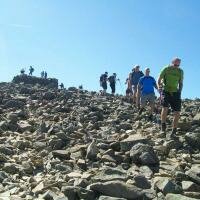
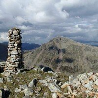
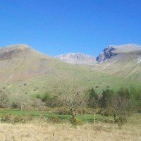
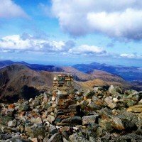
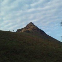
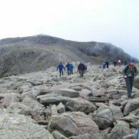
Scafell Pike, the highest mountain in England and probably the most popular mountain in the Lake District can be climbed relatively easily from any of four valleys, Langdale, Borrowdale, Wasdale and Eskdale with the ascents from Wasdale and Borrowdale being the most popular routes.
From Borrowdale a good circular route climbs from Seathwaite with a choice of paths, one climbing by Sty Head and the Corridor Route to Lingmell Col and the summit of Scafell Pike, the other climbing by the Grains Gill path to Esk Hause and following the ridge over Ill Crag and Broad Crag to the summit of Scafell Pike, these two routes make a classic circular days walking.
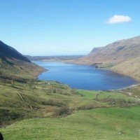
From Wasdale the distance is a little less, but the gradient a little steeper, and there is a wide choice of paths climbing to the summit of Scafell Pike, the most popular and most direct being the path by Brown Tongue and Lingmell Col, but several good alternatives are on offer also.
The summit of Scafell Pike offers as good a viewpoint as would be expected from the highest point in the land, a full 360° panorama of the Lake District and west across the Irish sea, on a good day the Blackpool Tower, The Isle of Man, Scotland and Wales can all be seen and on a very rare occasion Ireland can be seen beyond the Isle of Man.
- 1
- 2
-
Scafell Pike from Seathwaite
£22.00Learn MoreDifficulty:
Exposure:
A long walk over rough ground but probably the best way to see the best of Scafell Pike Distance: 14km / 9 miles Ascent: 1190m / 3900ft Duration: 7 hours Maximum Group Ratio: 10:1 -
Pen, Scafell Pike & Scafell
£22.00Learn MoreDifficulty:
Exposure:
This walk offers a unique opportunity to summit both Scafell Pike and Scafell in a way most walkers have never considered climbing Distance: 16km / 10 miles Ascent: 1300m / 4300ft Duration: 7 hours Maximum Group Ratio: 10:1 -
Scafell Pike from Wasdale Head
£22.00Learn MoreDifficulty:
Exposure:
A steep climb to start then great walking through heathery fellside with stunning views over Ullswater throughout Distance: 8km / 5 miles Ascent: 620m / 2000ft Duration: 4 hours Maximum Group Ratio: 10:1 -
Scafell & Scafell Pike
£22.00Learn MoreDifficulty:
Exposure:
Plenty of uphill and a few scrambles but a great day with dramatic scenery climbing the two highest mountains in England Distance: 12km / 7 miles Ascent: 1190m / 4000ft Duration: 7 hours Maximum Group Ratio: 10:1 -
Scafell Pike from Langdale
£22.00Learn MoreDifficulty:
Exposure:
A long walk over rough ground but a more accessible start point for many people
Distance: 18km / 11 miles Ascent: 1300m / 43000ft Duration: 8 hours Maximum Group Ratio: 10:1 -
The Wasdale Horseshoe
£30.00Learn MoreDifficulty:
Exposure:
A very long day above the Wasdale Valley covering some of the most iconic summits in England Distance: 20km / 12 miles Ascent: 2800m / 9200ft Duration: 14 hours Maximum Group Ratio: 10:1 -
Borrowdale 10 Challenge
£30.00Learn MoreDifficulty:
Exposure:
A challenging day over rough ground taking in several of the highest mountains in England Distance: 21km / 13 miles Ascent: 1890m / 6200ft Duration: 11 hours Maximum Group Ratio: 10:1 -
Scafell Pike from Sea to Summit
£35.00Learn MoreDifficulty:
Exposure:
A long day climbing Scafell Pike from Ravenglass along the Eskdale Valley
Distance: 26km / 16 miles Ascent: 1300m / 4290ft Duration: 12 hours Maximum Group Ratio: 10:1 -
Borrowdale Walking Weekend
Regular Price: £44.00
Special Price £40.00
Learn MoreDifficulty:
Exposure:
Two longer days of walking on rough ground Distance: Up to 14km / 9 miles per day Ascent: Up to 1190m / 3900ft per day Duration: 2 Days Maximum Group Ratio: 10:1 -
Wasdale Walking Weekend
Regular Price: £44.00
Special Price £40.00
Learn MoreDifficulty:
Exposure:
Two great days walking above Ullswater, high levels of exposure on the Striding Edge ridge Distance: Up to 13km / 8 miles per day Ascent: Up to 1050m / 3400ft per day Duration: 2 days Maximum Group Ratio: 8:1
- 1
- 2
Shopping Options
- Price
-
- £0.00 - £24.99 (5)
- £25.00 - £49.99 (5)
- £50.00 - £74.99 (3)
- £100.00 - £124.99 (1)
- £175.00 - £199.99 (2)
- £275.00 - £299.99 (1)
- £350.00 and above (2)
- Event Type
-
- 01: Diary Walks (7)
- 06: Walking Weekends (2)
- 17: Private Guiding (1)
You have no events to compare.
Join us on Facebook and hear about our news and see photos.
- YouTube
Phone: (Local Rate)
Email:
Our events are run on location throughout Great Britain, please check your booking information for specific event information including where to meet and directions to start points
 © 2015 The Lake District Walker Limited. All Rights Reserved.


