“The fell, indeed, has all the qualities of ruggedness and cragginess characteristic of the Wasdale mountains, and the approaches to it have charm of surroundings not usually associated with such rough terrain”
A Wainwright
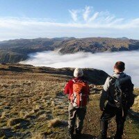
The high ground to the south of Ennerdale is some of the most remote and least visited in Lakeland, this route, from the shores of Ennerdale Water climbs four of the mountains in this area, the lower summits of Crag Fell and Grike before climbing over the huge expanse of Caw Fell, the huge rolling ridge climbing high above Ennerdale towards the higher fells of Wasdale.
The ridge leads east from Caw Fell to climb to the rocky summit of Haycock, from the summit of Haycock we will descend north to the Ennerdale Valley to the shores of Ennerdale Water following the shoreline back below Anglers Crag.
“Caw Fell is a fell that should not be under-estimated. It is remote from shelter or habitation”
A Wainwright
From the car park near Bleach Green Cottages we will climb south through the trees above Crag House Farm above Ben Gill to the summit of Crag Fell with its dramatic views over Ennerdale Water and west over the coast.
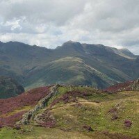
From Crag Fell we will walk the short distance west to the summit of Grike, on the westernmost edge of the Lake District, the descent from Grike will bring us through a short section of woods before we emerge on the lower slopes of Caw Fell, we will follow the wall, known as the Ennerdale Fence, the boundary wall marking the catchment area for the Ennerdale Water Reservoir below.
The long ridge climbs gently over Boathow Crag and Iron Crag until it reaches the summit of Caw Fell.
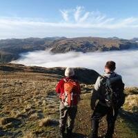
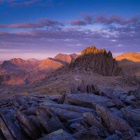
We will then follow the wall west climbing over Little Gowder Crag to the summit of Haycock, the highest point of the day, a great viewpoint over Ennerdale and across Wasdale to the Scafell range.
The descent from Haycock will bring us north over Tewit How before descending to cross Woundell Beck and cross the fields to the eastern shore of Ennerdale Water.
The path back to Bleach Green Cottages takes us along the southern shores of Ennerdale Water, a scenic and dramatic path that scrambles over rocky ground below Anglers Crag and back to the start point.
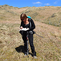
Each participant will be required to bring suitable equipment for their chosen event, please see Kit List tab above.
Where to meet: Ennerdale Water Car Park, Near Bleach Green Cottages
Postcode: CA23 3AS
Grid Reference: NY 085 154
Directions
From Cockermouth: Follow the A5086 south from Cockermouth, until shortly after the Lamplugh Tip pub is passed to the right turn left, on the road signposted to Kirkland and Ennerdale Bridge.
Follow the road through Kirkland and down the hill into Ennerdale Bridge, turn left in the village just after the Shepherds Arms and take the next right, through the forest where after a left and then a right turn will come to a car park on the left of the road, just past the campsite, we will meet at the car park.
Bus Services
There are no bus services to Ennderdale Water.
Stagecoach bus timetables can be viewed here


 © 2024 The Lake District Walker Limited. All Rights Reserved.