- Home /
- Private Guiding /
- North Western Fells /
- Hopegill Head
Hopegill Head


| Grid Reference: | NY 18566 22165 |
| Height: | 770 metres/2526 feet |
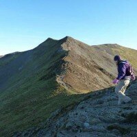
| "A high mountain ridge leaps like a rainbow from the woods and fields of Brackenthwaite and arcs through the sky for five miles to the east where the descending curve comes down to the village of Braithwaite. This ridge has three main summits, of which the central one (and the finest, but not the highest) is known locally as Hobcarton Pike and to mapmakers as Hopegill Head." |
|
A Wainwright
|
The rocky summit of Hopegill Head, above Coledale Hause is the centre point of the ridge running east west from Lanthwaite Green, above Crummock Water to Braithwaite. To the east the summit of Grisedale Pike leads towards Braithwaite and west the fine ridge of Whiteside continues before descending over Whin Ben to Lanthwaite Green.
A good grassy ridge descends to the north over Ladyside Pike, not a well know but a favourite of many who live locally.
To the north of Hopegill Head Hobcarton Crag descends steeply to the Swinside Plantation deep in the valley below. To see Hobcarton Crag to it's fullest the ridge to Grisedale Pike should be followed.
-
Coledale Horseshoe: Private Guiding
£140.00 As low as: £18.00Learn MoreDifficulty:Exposure:Distance: 16km / 10 milesAscent: 1200m / 3700ftDuration: 7 hoursMaximum Group Ratio: 10:1A long walk taking in plenty of tops, but with little exposure, and great views throughout
-
Lanthwaite to Braithwaite: Private Guiding
£140.00 As low as: £18.00Learn MoreDifficulty:Exposure:Distance: 8.5km / 5 milesAscent: 820m / 2700ftDuration: 5 hoursMaximum Group Ratio: 10:1A steep start but then a fine ridge walk with great views
-
Grasmoor End to Whiteside: Private Guiding
£140.00 As low as: £18.00Learn MoreDifficulty:Exposure:Distance: 9km / 5 milesAscent: 960m / 3200ftDuration: 6 hoursMaximum Group Ratio: 10:1A long but easy scramble up the dramatic face of Grasmoor End, stunning views thoughout
-
Buttermere to Braithwaite: Private Guiding
£140.00 As low as: £18.00Learn MoreDifficulty:Exposure:Distance: 14km / 9 milesAscent: 1120m / 3500ftDuration: 7 hoursMaximum Group Ratio: 10:1A wonderful linear walk taking in some of the best summits in the North Western Fells, including the wonderful Grasmoor, Whiteless Pike, Grisedale Pike and Hopegill Head
You have no events to compare.




 © 2024 The Lake District Walker Limited. All Rights Reserved.