-
- | Add to Compare
-
- | Add to Compare
-
- | Add to Compare
-
- | Add to Compare
Welcome to The Lake District Walker
- My Account
- My Cart
- Checkout
- Log In
- Testimonials
- Diary
-
Routes
- Most Popular
Scafell Pike from Seathwaite
Helvellyn & Striding Edge
The Fairfield Horseshoe
Scafell Pike from Wasdale
Langdale Pikes
Blencathra & Sharp Edge -
Central Fells
High Raise
Harrison Stickle
Sergeant Man
Helm Crag
Loughrigg
All Central Fells -
Eastern Fells
Helvellyn
Fairfield
Red Screes
Sheffield Pike
St Sundays Crag
All Eastern Fells -
Far Eastern Fells
High Street
High Raise
Thornthwaite Crag
Harter Fell
Wansfell
All Far Eastern Fells -
Northern Fells
Skiddaw
Blencathra
Carrock Fell
Bannerdale Crags
Latrigg
All Northern Fells -
North Western Fells
Grasmoor
Grisedale Pike
Dale Head
Causey Pike
Catbells
All North Western Fells -
Southern Fells
Scafell Pike
Bowfell
Coniston Old Man
The Crinkles
Wetherlam
All Southern Fells -
Western Fells
Great Gable
Pillar
High Stile
Haystacks
Haycock
All Western Fells -
Walking Weekends
Evening Walks
Scottish Walks
Welsh Walks
Yorkshire Walks
Challenge Events - Outside the Lake District
Yorkshire 3 Peaks
Ben Nevis by the CMD Arete
All Ben Nevis Routes
Snowdon & Crib Goch
All Snowdon Routes
All Routes Outside the Lake District
- Most Popular
-
Ghyll Scrambling
- Ghyll Scrambling
Which ghyll is best for me?
Full Diary
Private Events
Activity Days
Rock Climbing
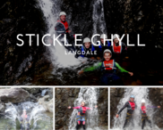
- Stickle Ghyll, Langdale
-
Stonycroft Ghyll, Newlands
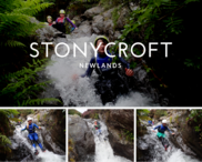
A fun packed scramble down the ghyll, packed with slides, dives and a few great jumps
Duration: Up to 3 hours -
Church Beck, Coniston
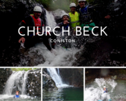
A great scramble up an impressive gorge, great jumps along the way
Duration: Up to 3 hours -
The Esk Gorge
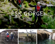
A longer day taking on the most exhillerating Gorge in the Lake District
Duration: 5-6 hours
- Ghyll Scrambling
-
Navigation & Skills
- Navigation & Skills Courses
Which Nav course is best for me?
Special Offer Navigation Courses
Beginners Navigation Course
Advanced Navigation Course
NNAS Navigation Courses
Private Navigation Courses
Lake District Winter Skills Courses
Scottish Winter Skills Courses
Private Winter Skills Courses
ML Refresher Courses
-
Navigation Courses
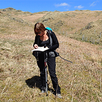
A wide range on navigation courses
From Beginners to NNAS Gold
-
Navigation Special Offers
-
Winter Skills
-
ML Refresher Courses
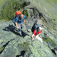
A variety of courses for anyone looking to take their Mountain Leader qualification, or looking to inprove their skills
- Navigation & Skills Courses
- Challenge
-
Private Guiding
-
Most Popular
Scafell Pike from Seathwaite
Helvellyn & Striding Edge
The Fairfield Horseshoe
Scafell Pike from Wasdale
Langdale Pikes
Blencathra & Sharp Edge -
Walks By Difficulty
Low Level Walks
Easier Fell Walks
Moderate Fell Walks
Harder Fell Walks
Challenges
Evening Walks -
Challenge Events
Yorkshire 3 Peaks
10 Peak Challenge
24 Peak Challenge
Lakes 3000's Challenge
Borrowdale 10 Challenge
Challenge Events -
Skills Courses
Navigation Courses
Winter Skills Courses
ML Refresher Courses
NNAS Navigation Courses
First Aid Courses
All Skills Courses -
Hire A Guide
Can't find the event you want listed on our website?
Book a guide here and sort out the details later.
For long days or climbing please ring -
Scafell Pike
Scafell Pike from Seathwaite
Scafell Pike from Wasdale
Scafell & Scafell Pike
Scafell Pike from Langdale
Scafell Pike from Eskdale
All Scafell Pike routes -
Helvellyn
Helvellyn & Striding Edge
Helvellyn from Wythburn
Helvellyn, Raise & Whiteside
Fairfield & Helvellyn
Helvellyn Overnight Walks
All Helvellyn routes -
Ghyll Scrambling
Stickle Gill, Langdale
Stoneycroft Gill, Newlands
Church Beck, Coniston
The Esk Gorge
All Ghyll Scrambles - Classic Winter Walks
Scafell Pike from Seathwaite
Bowfell & The Crinkles
Helvellyn from Wythburn
Great End from Seathwaite
High Street from Hartsop
The Fairfield Horseshoe -
Outside the Lakes
Ben Nevis
Snowdon
Yorkshire 3 Peaks
Ring of Steall
Tryfan & the Glydders
All Options
-
Most Popular
- Gift Vouchers
- You have no items in your shopping cart.
Join us on Facebook and hear about our news and see photos.
- YouTube
Email:
 © 2024 The Lake District Walker Limited. All Rights Reserved.

