“If a visitor to Lakeland has only two or three hours to spare, poor fellow, yet desperately wants to reach a summit and take back an enduring memory of the beauty of the district.....let him climb Castle Crag”
A Wainwright
Although the lowest summit of Wainwright's Lakeland Fells Castle Crag can lay claim to being one of the loveliest, Wainwright described the wooded area between Castle Crag and the River Derwent as “the loveliest square mile in Lakeland”.
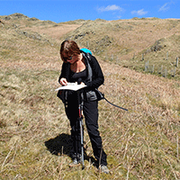
This route takes in the best that Castle Crag and the surrounding area has to offer, as well as the summit viewpoint we will take in rivers, caves and mining history.
“Castle Crag is so magnificently independent, so ruggedly individual, so aggressively unashamed unashamed of it's lack of inches, that less than justice would be done by relegating it to a paragraph in the High Spy chapter”
A Wainwright
From Grange our route follows the track south, through the campsite to meet the river at Gowder Dub, a popular swimming spot during the summer months and during quieter seasons a great place to spot wildlife in or on the river.
From Gowder Dub our route takes the old mine track up by Broadslack Gill, a well made track that once used to serve the mines around Goat Crag and Rigghead Quarries before continuing up towards Honister Pass.
Towards the top of the slope a smaller path heads off to the left, climbing up to cross the wall and then up to a stile across the fence and onto the quarried fellside above.
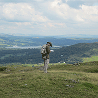
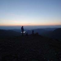
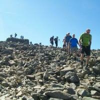
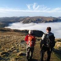
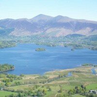
The path zig zags across the stony quarry ground to the summit of Castle Crag, a wonderful viewpoint over the Borrowdale Valley and across Derwentwater to Keswick and Skiddaw.
The summit of Castle Crag is marked by a war memorial, dedicated to the Borrowdale Valley men killed in World War I, a remembrance service takes place here annually on Remembrance Sunday.
From the summit of Castle Crag we will retrace our steps down over the quarried ground to the wall below where a ladder stile leads onto the open fellside to the south, here a good path descends steeply to the east past some mine workings to emerge from the woods on the Cumbria Way by the River Derwent.
Our route now follows the Cumbria Way north, following the banks of the River Derwent back to Gowder Dub and the village of Grange, along this track there is much of interest though, wonderful woodland, a picturesque river in which trout can often be watched and the famous caves once inhabited by Millican Dalton, otherwise known as the 'Professor Of Adventure' who was one of the early Lakeland guides, spending his summer months living in a cave here on the slopes of Castle Crag.
A short walk from the caves bring us back to Gowder Sub and the track back into Grange.
Each participant will be required to bring suitable equipment for their chosen event, please see Kit List tab above.
Where to meet: Grange Bridge, Borrowdale
Postcode: CA12 5UQ
Grid Reference: NY 253 174
Directions
From Keswick: Leave Keswick on the Borrowdale Road (from the mini roundabout near the co-op) Follow this road past the lake until a road leads to the right, crossing a long but narrow bridge, we will meet at the small car park on the opposite end of the bridge.
Bus Services
Grange is well served by buses, the bus stop is 100m away from the meet point.
The 78 bus runs between Keswick and Seatoller along the Borrowdale Valley.
The 77/77a runs from Keswick to Buttermere during the summer months (Easter to October Half Term).
Stagecoach bus timetables can be viewed here
-
Thank you for such a lovely walk up Castle Crag Review by Marion McCormick
Thank you for such a lovely walk up Castle Crag. I would never have done it on my own. I learnt so much about the geology and history of the area. John was so calm and gave me the confidence I needed. Paddy (spaniel) enjoyed it also. Thanks so much. Will book again soon. Marion McCormick (Posted on 19/04/2018)


 © 2024 The Lake District Walker Limited. All Rights Reserved.