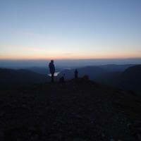
Welcome to The Lake District Walker
Scafell Pike from Seathwaite
Helvellyn & Striding Edge
The Fairfield Horseshoe
Scafell Pike from Wasdale
Langdale Pikes
Blencathra & Sharp Edge
High Raise
Harrison Stickle
Sergeant Man
Helm Crag
Loughrigg
All Central Fells
Helvellyn
Fairfield
Red Screes
Sheffield Pike
St Sundays Crag
All Eastern Fells
High Street
High Raise
Thornthwaite Crag
Harter Fell
Wansfell
All Far Eastern Fells
Skiddaw
Blencathra
Carrock Fell
Bannerdale Crags
Latrigg
All Northern Fells
Grasmoor
Grisedale Pike
Dale Head
Causey Pike
Catbells
All North Western Fells
Scafell Pike
Bowfell
Coniston Old Man
The Crinkles
Wetherlam
All Southern Fells
Great Gable
Pillar
High Stile
Haystacks
Haycock
All Western Fells
Walking Weekends
Evening Walks
Scottish Walks
Welsh Walks
Yorkshire Walks
Challenge Events
Yorkshire 3 Peaks
Ben Nevis by the CMD Arete
All Ben Nevis Routes
Snowdon & Crib Goch
All Snowdon Routes
All Routes Outside the Lake District
Which ghyll is best for me?
Full Diary
Private Events
Activity Days
Rock Climbing
A fun packed scramble down the ghyll, packed with slides, dives and a few great jumps
Duration: Up to 3 hours
A great scramble up an impressive gorge, great jumps along the way
Duration: Up to 3 hours
A longer day taking on the most exhillerating Gorge in the Lake District
Duration: 5-6 hours
Which Nav course is best for me?
Special Offer Navigation Courses
Beginners Navigation Course
Advanced Navigation Course
NNAS Navigation Courses
Private Navigation Courses
Lake District Winter Skills Courses
Scottish Winter Skills Courses
Private Winter Skills Courses
ML Refresher Courses
A wide range on navigation courses
From Beginners to NNAS Gold
A variety of courses for anyone looking to take their Mountain Leader qualification, or looking to inprove their skills
Scafell Pike from Seathwaite
Helvellyn & Striding Edge
The Fairfield Horseshoe
Scafell Pike from Wasdale
Langdale Pikes
Blencathra & Sharp Edge
Low Level Walks
Easier Fell Walks
Moderate Fell Walks
Harder Fell Walks
Challenges
Evening Walks
Yorkshire 3 Peaks
10 Peak Challenge
24 Peak Challenge
Lakes 3000's Challenge
Borrowdale 10 Challenge
Challenge Events
Navigation Courses
Winter Skills Courses
ML Refresher Courses
NNAS Navigation Courses
First Aid Courses
All Skills Courses
Can't find the event you want listed on our website?
Book a guide here and sort out the details later.
For long days or climbing please ring
Scafell Pike from Seathwaite
Scafell Pike from Wasdale
Scafell & Scafell Pike
Scafell Pike from Langdale
Scafell Pike from Eskdale
All Scafell Pike routes
Helvellyn & Striding Edge
Helvellyn from Wythburn
Helvellyn, Raise & Whiteside
Fairfield & Helvellyn
Helvellyn Overnight Walks
All Helvellyn routes
Stickle Gill, Langdale
Stoneycroft Gill, Newlands
Church Beck, Coniston
The Esk Gorge
All Ghyll Scrambles
Scafell Pike from Seathwaite
Bowfell & The Crinkles
Helvellyn from Wythburn
Great End from Seathwaite
High Street from Hartsop
The Fairfield Horseshoe
Ben Nevis
Snowdon
Yorkshire 3 Peaks
Ring of Steall
Tryfan & the Glydders
All Options
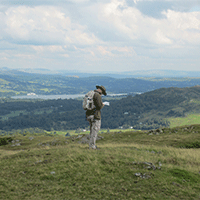
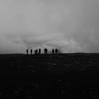
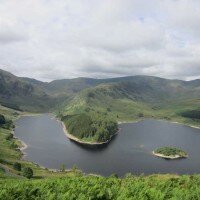
The ever popular Coniston Fells are a heaven for fellwalkers but almost all climb from the more popular Coniston side of the range, to the west lies the more secluded Duddon Valley, here from the village of Seathwaite a wonderful circuit can be made taking in the lesser frequented summits of the range as well as the major tops of Swirl How and the Old Man of Coniston.
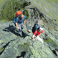
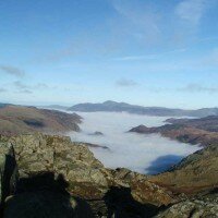
Summits included on this route:
Grey Friar770 metres / 2526 feet
Great Carrs780 metres / 2559 feet
Swirl How802 metres / 2631 feet
Brim Fell796 metres / 2612 feet
Coniston Old Man803 metres / 2635 feet
Dow Crag778 metres / 2552 feet
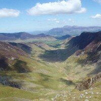
From Birks Bridge we will climb by Pike How onto the open fellside below Seathwaite Tarn, following the ridge over Troutal Fell to reach the summit of Grey Friar.
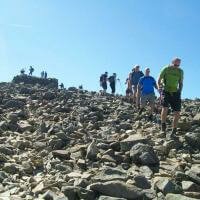
From Grey Friar we will climb east to the summit of Great Cars and follow the ridge south to Swirl How. From Swirl How the wonderful ridge south leads us over Levers Hause to the summits of Brim Fell and then Coniston Old Man before we drop down to Goats Hause, climbing again to the summit of Dow Crag.
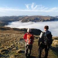
The gentle ridge south leads over the summits of Buck Pike and Brown Pike to meet the Walna Scar Road and descend west into the Duddon Valley and back to Birks Bridge.
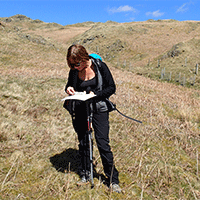
Each participant will be required to bring suitable equipment for their chosen event, please see Kit List tab above.
Group Size | 1 | 2 | 3 | 4 | 5 | 6 | 7 | 8 | 9 | 10 |
Per Person | £140 | £70 | £50 | £37.50 | £30 | £25 | £22 | £20 | £20 | £18 |
Per Group | £140 | £140 | £150 | £150 | £150 | £150 | £154 | £160 | £180 | £180 |
Group Size | 11 | 12 | 13 | 14 | 15 | 16 | 17 | 18 | 19 | 20 |
Per Person | £27 | £25 | £23 | £22 | £21 | £20 | £19 | £19 | £19 | £18 |
Per Group | £297 | £300 | £299 | £308 | £315 | £320 | £323 | £324 | £342 | £360 |
Group Size | 21 | 22 | 23 | 24 | 25 | 26 | 27 | 28 | 29 | 30+ |
Per Person | £22 | £21 | £21 | £20 | £20 | £20 | £19 | £19 | £18 | £18 |
Per Group | £462 | £484 | £506 | £528 | £525 | £546 | £513 | £504 | £522 | £540 |
Where to meet: Birks Bridge
Postcode: LA20 6EF (approximate)
Grid Reference: SD 239 995
The Duddon Valley is one of the more remote areas of the Lake District so please allow plenty of time, from Ambleside the most direct route is over the Hardknott Pass, after crossing the pass turn left at Cockley Beck and follow the road 2 miles until the car park is seen to the right.
Alternitavely from the south turn off the A595 at Bank End, by the Duddon Bridge, and follow this road through Ulpha and Seathwaite, after crossing the Cattle Grid the car park will be seen to the left after just under 1 mile.
There are no bus services along the Duddon Valley.
Stagecoach bus timetables can be viewed here
Summer Walks:
Winter Walks:
The Following equipment may also be useful if owned:
The following equipment will be provided by The Lake District Walker should winter conditions require:
Use spaces to separate tags. Use single quotes (') for phrases.
What happens if the weather is bad?
We plan to walk whatever the weather, unless it is dangerous to do so.
Mountain weather can be a little unpredictable, but we do keep an eye on the forecasts leading up to walks, should the forecast mean that the walk is not possible then we will contact you as soon as we have the forecast and offer you the following options:
Are dogs allowed on this walk?
Yes, dogs are allowed on all our walks.
However we do cross farmland and common land where animals will be grazing, there will be large sections of the walk, if not all, where dogs will be required to be on a lead.
There are sections of this walk across rough ground and boulders and as such this walk may not be suitable for all dogs.
Please login to your account to post a question
Join us on Facebook and hear about our news and see photos.